
Canadian Middle Arctic Tundra
The ecoregion’s land area is provided in units of 1,000 hectares. The protection goal is the Global Safety Net (GSN1) area for the given ecoregion. The protection level indicates the percentage of the GSN goal that is currently protected on a scale of 0-10.
Bioregion: Canadian Tundra (NA2)
Realm: Subarctic America
Ecoregion Size (1000 ha):
98,110
Ecoregion ID:
414
Conservation Target:
89%
Protection Level:
1
States: Canada: NT, NU, QC
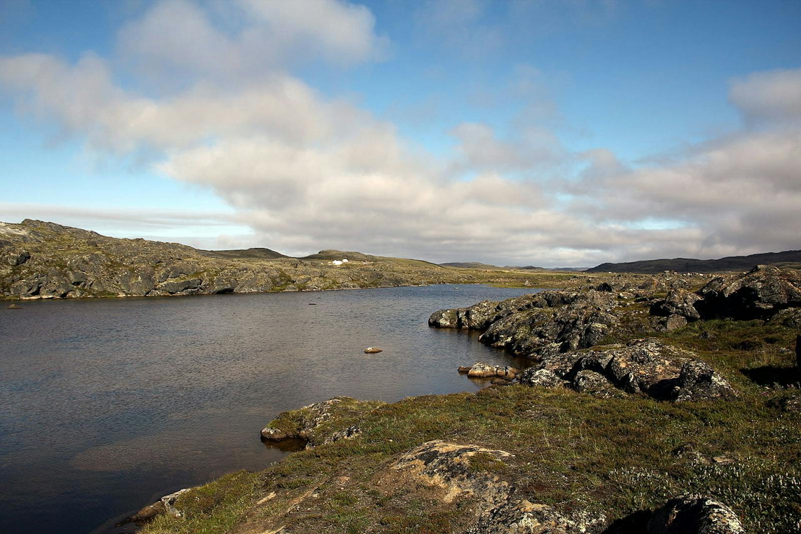
The Canadian Middle Arctic Tundra ecoregion is the second-largest ecoregion in Northern America Realm. It lies between the Canadian High Arctic Tundra to the north and the Canadian Low Arctic Tundra to the south and is ecologically transitional between these two ecoregions. It includes several disjunct mainland areas of the northern Northwest Territories and Nunavut to Hudson Bay, northern Southampton Island in Hudson Bay, the tip of the Ungava Peninsula in northern Quebec, and then encompasses Banks Island, Victoria Island, southern Prince of Wales and Somerset Islands, about half of Baffin Island, and several smaller islands in the Arctic Ocean.
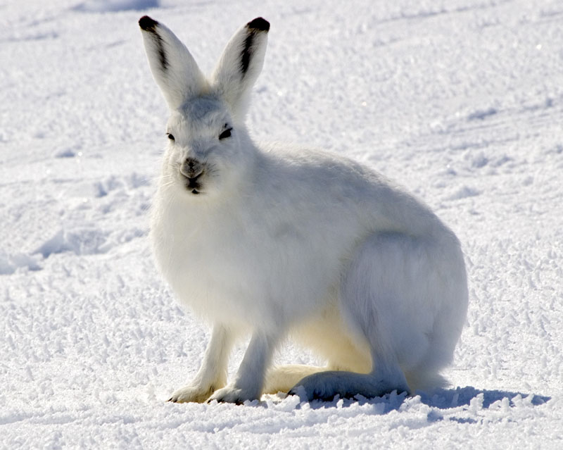
The flagship species of the Canadian Middle Arctic Tundra ecoregion is the Arctic hare. Image credit: Creative Commons
The ocean in the northern half of the ecoregion is ice-covered most of the year, although with global warming the area and duration of open-water conditions is increasing and moving northward. A little over 91% of this ecoregion is intact, but unfortunately only 6% lies within protected areas. Significant protected areas are Ukkusiksalik National Park on mainland Nunavut and Banks Island Migratory Bird Sanctuary and Aulavik National Park on Banks Island (Northwest Territories).
The climate of this ecoregion is mid-Arctic, with short, cool summers and long, very cold winters. In Canada, only the Canadian High Arctic Tundra has a colder and drier climate. The climate of both ecoregions is often described as polar desert or polar semi-desert. Mean summer temperatures range from 0.5ºC in the north-central part of the ecoregion to 4.5ºC in the south-central area. Average winter temperatures range from -30ºC in the western and northern areas to -20ºC on the Ungawa Peninsula. Permafrost is mostly continuous and can extend to a depth of several hundred meters.
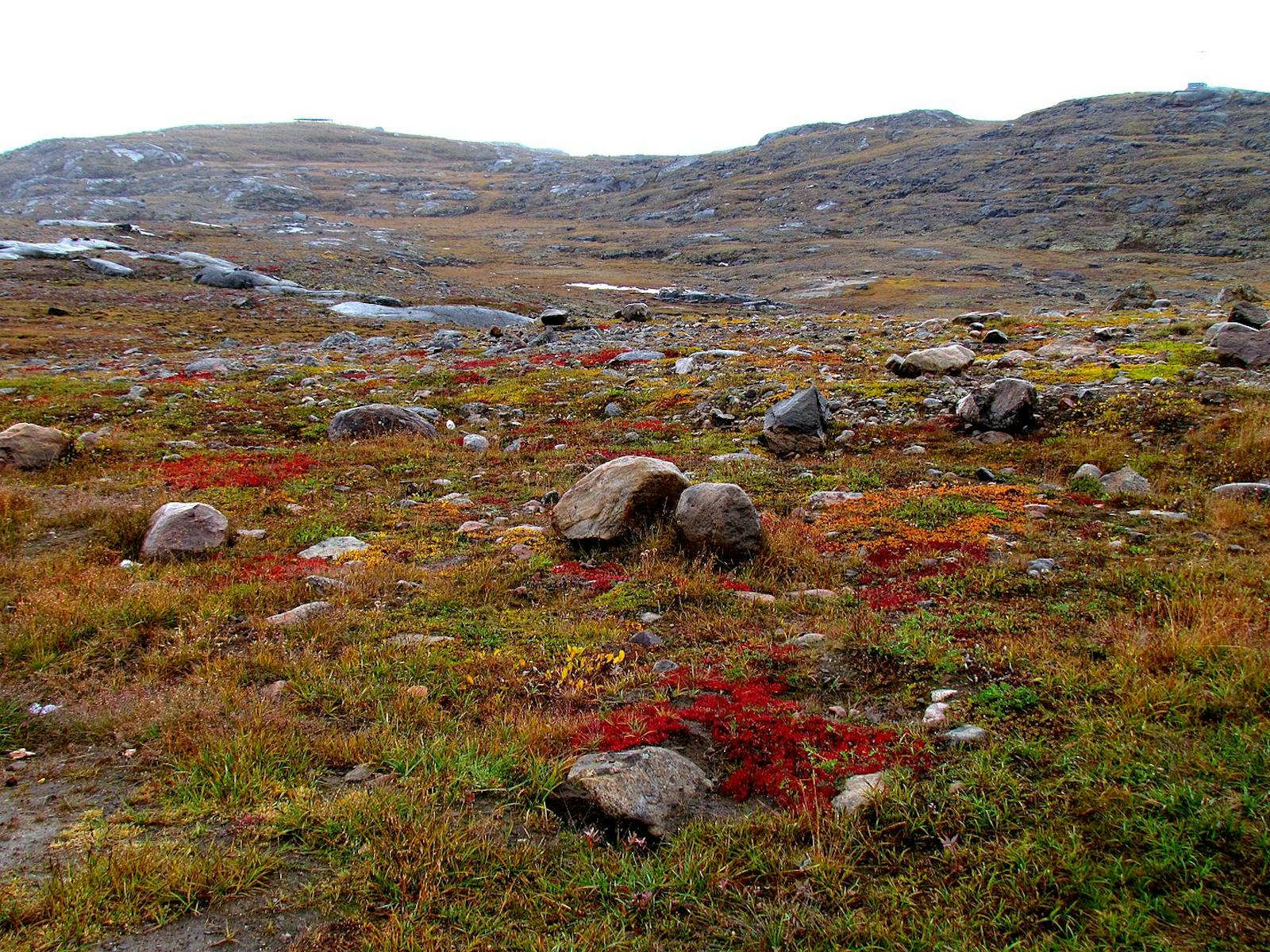
Mean annual precipitation is only 100–200 mm, with higher values occasionally found in the southeast (Ungawa Peninsula). Sparse vegetation of lichens, herbs, and dwarf shrubs (especially Arctic willow, mountain avens, and plants in the heath family) is characteristic of this ecoregion. Low, wet areas, such as along streams and in deltas, often have a dense growth of sedges (e.g., cottongrass) and grasses. In the eastern portion of the ecoregion, alder and willow join dwarf birch on warm sites.
Some characteristic mammals found in this ecoregion are caribou, musk ox, polar bear, Arctic wolf, Arctic fox, Arctic hare, Arctic ground squirrel, brown lemming, and collared lemming. The caribou is the endangered Peary caribou, which this ecoregion shares with the Canadian High Arctic ecoregion. This is the smallest subspecies of caribou in North America (violating the generalization known as Bergmann’s Rule, where body size within species of mammals and birds increases with increasing latitude). The Peary caribou population dropped from more than 40,000 in 1961 to about 700 in 2009. This dramatic decline is linked to an increased number of days with temperatures above freezing, which results in ice layers in the snow pack that interfere with foraging.i
The densest population of musk ox in the world reportedly occurs on Banks Island, with 68,000 to 80,000 animals.ii Typical marine mammals of the ecoregion include beluga whale, bowhead whale, walrus, narwhal, and several species of seals. This ecoregion is quite important for birds. Banks Island Migratory Bird Sanctuary is recognized internationally as an Audubon Important Bird Area, especially because of its large population of lesser snow geese. Some 450,000 of these birds nest here, which represents approximately 95% of the Western Arctic population and about 15% of the Canadian lesser snow goose population.iii
The sanctuary is also significant nesting habitat for other bird species, especially black brant, king eider, long-tailed duck, tundra swan, Ross’s goose, and sandhill crane. Other characteristic birds of the ecoregion include loons (red-throated, yellow-billed, and Arctic), many species of sandpipers and plovers, gyrfalcon, peregrine falcon, rough-legged hawk, willow and rock ptarmigan, red phalarope, parasitic and long-tailed jaeger, snowy owl, and snow bunting.
The low level of protection for this remote and mostly wild ecoregion is surprising and should be remedied. Mining and associated roads are the major threats to this ecoregion. Priority conservation actions for the next decade are: 1) greatly expand the network of protected areas across the ecoregion; 2) prohibit incompatible uses, including mining and intensive recreation, within designated protected areas; and 3) protect vulnerable species such as caribou and muskox from over-harvest.
Citations
1. Ricketts, T.H. et al. 1999. Terrestrial Ecoregions of North America: A Conservation Assessment. Island Press, Washington, D.C.
2. Ecological Stratification Working Group. 1995. A National Ecological Framework for Canada. Environment Canada and other agencies, Ottawa.
3. Ukkusiksalik National Park. https://en.wikipedia.org/wiki/Ukkusiksalik_National_Park

Subscribe to receive monthly updates on climate solutions, environmental heroes, and the profound beauty and wonder of our shared planet Earth.
