

Guinean Mangroves
The ecoregion’s land area is provided in units of 1,000 hectares. The protection goal is the Global Safety Net (GSN1) area for the given ecoregion. The protection level indicates the percentage of the GSN goal that is currently protected on a scale of 0-10.
Bioregion: West African Coastal Forests & Savanna (AT19)
Realm: Afrotropics
Ecoregion Size (1000 ha):
2,357
Ecoregion ID:
113
Conservation Target:
35%
Protection Level:
7
States: Senegal, The Gambia, Guinea-Bissau, Guinea, Sierra Leone, Liberia, Côte d’Ivoire
One of the largest populations of the West African Manatee, sometimes known as the “forgotten” sirenian, in Africa is found in Guinea-Bissau in this ecoregion. Mangrove forests, wetlands, and river systems harbor the mysterious creature. They are threatened by human activity, including illegal hunting for their meat and occasionally for their skin, bones, and oil for use in traditional medicines and rituals. More recent threats include dams, deforestation of mangroves for firewood, and the destruction of wetlands for agriculture and coastal development.
The flagship species of the Guinean Mangroves ecoregion is the West African manatee.
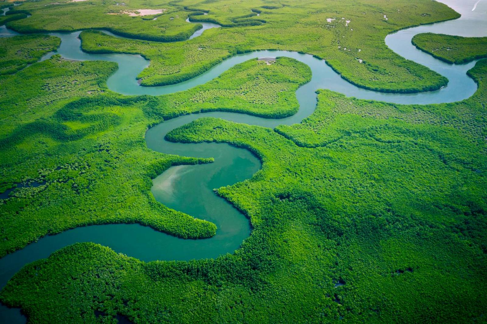
The Guinean Mangroves are located in western Africa and encompass mangrove stands along the coastlines of Senegal, Gambia, Guinea-Bissau, Guinea, Sierra Leone, Liberia, and Côte d’Ivoire. Temperatures range from 15°C and 28°C in the north to between 23°C and 32°C in Guinea. Annual rainfall varies greatly, from as low as 95 mm in the Senegal River Delta to approximately 9,000 mm in Sierra Leone. High freshwater inputs during the wet season reduce salinity levels. During the dry season, the marine influence is more widespread and reaches farther inland.
Extensive mangroves can be found where the flat topography of rivers and estuaries combine with high tidal amplitudes to allow tidal waters to penetrate deeply into the interior. This extends the habitat range of salt-tolerant mangrove species and allows for a greater degree of species zonation along the low- to high-water gradient. Mangrove forests provide many services, including a breeding ground for many fish, protection against floods, storm surges, and erosion, processing of organic matter, and sequestration of huge amounts of carbon.
.")
Cattle egret (Bubulcus ibis). Image credit: Ken and Nyetta, CC by 2.0
The West African mangrove species assemblages are more similar to those found in the western Atlantic than to those in eastern Africa. Native species include Rhizophora racemose, R. mangle, R. harrisonii, Avicennia germinanas, Conocarpus erectus, and Laguncularia racemose. There is also one introduced species, Nypa fruticans. Principal mangrove zones are the Avicennia-dominated swamps in Senegal and those in which Rhizophora species are the primary colonists, with Avicennia africana found in the interior.
High productivity and an extensive food web in the mangrove forests support migratory shorebird populations, important marine species, and offshore fisheries. The vertebrate fauna of these mangroves include the West African manatee, water chevrotain, pygmy crocodile, Nile monitor, and Nile crocodile. Primates include Temminick’s red colobus, western black and white colobus, and Campbell’s mona monkey.
.")
Atlantic mudskipper (Periophthalmus barbarus). Image credit: ID ©Ondřej Prosický | Dreamstime
Although no bird species are restricted to this ecoregion, it supports many species, including large numbers of migratory waterbirds that use the mangrove areas seasonally during their migrations between the Palearctic and Afrotropical realms. A common fish species that occurs in the mangroves is the Atlantic mudskipper, although other fish species are also present in the estuaries. Sea turtles also use this habitat, including olive ridley turtles, loggerhead turtles, and green turtles.
.")
Greater flamingo (Phoenicopterus roseus). Image credit: Elgollimoh, CC by SA 3.0
The largest stands of mangroves in this ecoregion are found in the Casamance Delta, the Saloum River in Senegal, and the Gambia River in the Gambia. Protected areas containing mangroves include Delta du Saloum in Senegal, which is 730 km2 in area, and the Basse-Casamance (50 km2). Others include Lagoa de Cufada ramsar site (391 km2), Varela National Park, Rio Cacheu Mangroves Natural Park, and Bijagos Archipelago Biosphere Reserve in Guinea-Bissau, Iles Ehotile National Park (5.5 km2) in Côte d’Ivoire, Tanbi Wetland Complex in Gambia, Iles Tristao Ramsar site in Guinea, Sierra Leone River Estuary Ramsar Site in Sierra Leone, and Lake Piso Multiple Sustainable Use Reserve in Liberia.
-CC-Charles%20J%20Sharp-2017.jpg)
Sacred ibis. Image credit: Charles J Sharp, Creative Commons
Of greatest concern is the loss of mangrove areas to rice farming, urban expansion, road construction, and shrimp farming. Small-scale fragmentation, however, does not greatly affect mangrove-associated biodiversity, as mangroves are naturally fragmented and are able to disperse over long distances.
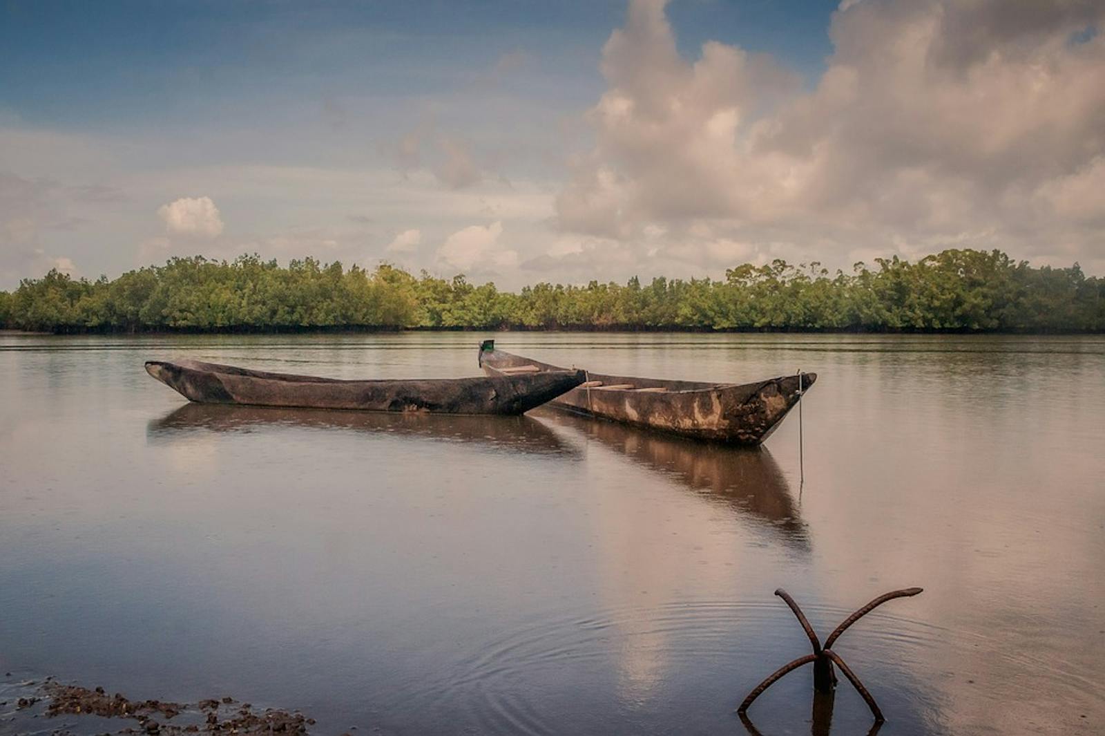
Throughout the ecoregion, mangrove wood is used for construction, as the trees are straight and possess termite resistant wood, for charcoal production, and for firewood. In addition, the latitudinal extent of the mangroves means that they are particularly vulnerable to climate change, which is predicted to result in a significant rise in sea level and increasing temperatures.
%20walking%20in%20shallow%20water%2C%20South%20Africa%20dreamstime.jpeg "Nile monitor (Varanus niloticus) walking in shallow water, South Africa.")
Nile monitor (Varanus niloticus) walking in shallow water, South Africa. Image credit: ©Ecophoto | Dreamstime
Dam construction also interferes with the hydrological regime, such as the Diama Dam in the Senegal estuary. In Côte d’Ivoire, the reduction of freshwater inputs allows the sea swell to deposit sand, sufficient to obstruct access between the lagoons and the sea. Other threats include aquaculture, which leads to water eutrophication, the destruction of mangrove trees, and pollution. Additionally, the management of mangroves is embedded under wider environmental legislation, preventing effective protection of the ecosystem.
Priority conservation actions for the next decade.
- Support local community participation in the rehabilitation and restoration of mangrove ecosystems;
- Encourage the use of mapping and remote sensing to monitor the effectiveness of conservation projects as well as identify the priority areas;
- Develop policies and regulations that encourage economic incentives for conserving the ecosystem as well as improving enforcement of this legislation.
-
-
1. Burgess, N., Hales, J.A., Underwood, E., Dinerstein, E., Olson, D., Itoua, I., Schipper, J., Ricketts, T. and Newman, K. 2004. Terrestrial ecoregions of Africa and Madagascar: a conservation assessment. Island Press.
2. CEPF. 2015. Ecosystem Profile: Guinean Forests of West Africa Biodiversity Hotspot. [Online]. [Accessed 19 March 2018]. Available from: https://www.cepf.net/sites/default/files/en_guinean_forests_ecosystem_profile.pdf
3. Feka, Z.N. and Morrison, I. 2017. Managing mangroves for coastal ecosystems change: A decade and beyond of conservation experiences and lessons for and from west-central Africa. Journal of Ecology and The Natural Environment. 9(6), pp.99-123.
4. Feka, Z.N. 2015. Sustainable management of mangrove forests in West Africa: A new policy perspective? Ocean & Coastal Management. 116, pp.341-352. -
Cite this page: Guinean Mangroves. Ecoregion Snapshots: Descriptive Abstracts of the Terrestrial Ecoregions of the World, 2021. Developed by One Earth and RESOLVE. https://www.oneearth.org/ecoregions/guinean-mangroves/
-

Subscribe to receive monthly updates on climate solutions, environmental heroes, and the profound beauty and wonder of our shared planet Earth.
