

Kalahari Acacia Woodlands
The ecoregion’s land area is provided in units of 1,000 hectares. The conservation target is the Global Safety Net (GSN1) area for the given ecoregion. The protection level indicates the percentage of the GSN goal that is currently protected on a scale of 0-10. N/A means data is not available at this time.
Bioregion: Greater Karoo & Kalahari Drylands (AT9)
Realm: Afrotropics
Ecoregion Size (1000 ha):
10,696
Ecoregion ID:
47
Conservation Target:
91%
Protection Level:
6
States: Botswana, Namibia
The Kalahari Acacia Woodlands ecoregion was once part of an important seasonal migration route for large herbivores, including the blue wildebeest, eland, Burchell’s zebra, buffalo, and hartebeest, especially during droughts. The outbreaks of foot and mouth disease in the 1950s led to the erection hundreds of kilometers of veterinary fences in, many crossing the ecoregion, to isolate cattle from wild buffalo, which were thought to be the main carriers of the disease. The fences still remain today and continue to disrupt the migration of wildebeest and hartebeest from the Kalahari Desert to the Okavango delta, and because of this their populations in the Kalahari have collapsed.
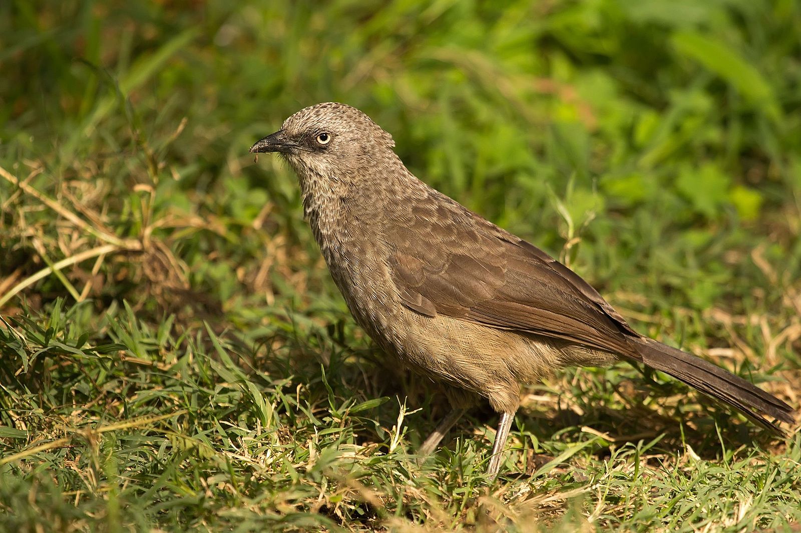
The flagship species of the Kalahari Acacia Woodlands ecoregion is the black-lored babbler. Image credit: Creative Commons
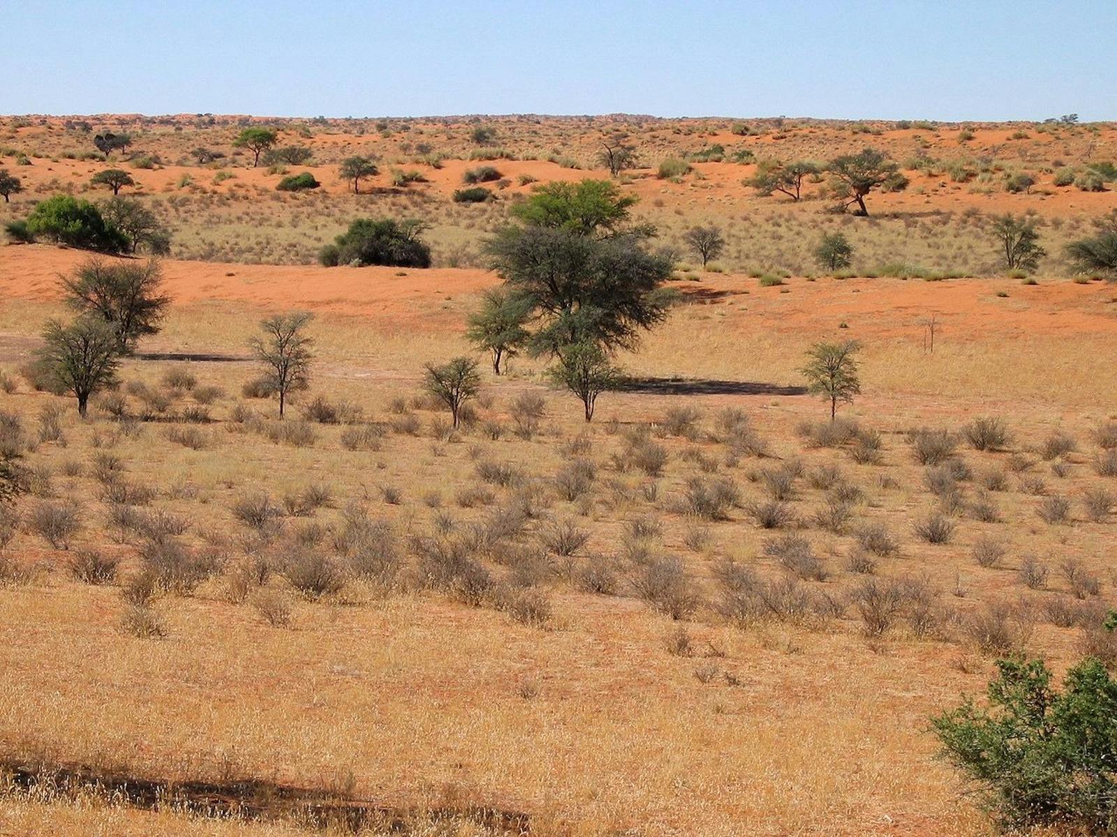
The Kalahari Acacia Woodlands occupy a broad band of land that runs from northern Namibia and extends across to Botswana, just east of the Okavango Delta. The ecoregion lies in the center of the Great African Plateau at an elevation of about 1,000 m. The climate of the ecoregion is semi-arid, with droughts occurring on an approximate seven-year cycle.
Rainfall occurs mostly in the summer months, from October through March. During the winter months – from May through August – there is little or no rain. The annual rainfall ranges from about 300 mm in the southwest to 600 mm in the north, varying from year to year. Surface water is scarce. Surface drainage over the sandveld areas is mainly restricted to pans and dry valleys, and is only present after rain. Temperatures are typical of a continental climate, with high diurnal and seasonal ranges. In June and July, temperatures can drop below freezing, but in the summer months temperatures may exceed 40°C.
_male-CC-Charles%20J%20Sharp-2014_resized.jpg)
Roan antelope. Image credit: Charles J Sharp, Creative Commons
The dominant trees in the coreof the ecoregion are Lonchocarpus nelsii, Terminalia sercea, Burkea Africana, Combretum spp., Acacia erioloba, and A. luederitzii. In the sandveld, taller trees are mainly confined to low sand ridges, which are also dominated by Peltophorum africanum, Croton gratissimus, A. fleckii, and Combretum zeyheri. On the hardveld, vegetation patterns are complex as a result of changing soil types, linked with complex changes in the underlying topography. Dominating vegetation includes Colophospermum mopane, Cencrus ciliarus, Acacia nigrescenes, Combretum apiculatum, and C. imbrebe.
The ecoregion spans the southern extent of the Zambezian regional center of endemism; nonetheless, flora and faunal species richness and endemism is low. However, many of the charismatic large mammals associated with African savannas occur, such as blue wildebeest, hartebeest, greater kudu, and eland. There are several threatened large mammals as well, including elephant, cheetah, lion, and African wild dog. The estimated population of remaining cheetah population in this ecoregion is only 296 individuals. More arid-loving animals such as the gemsbok and springbok are also found.
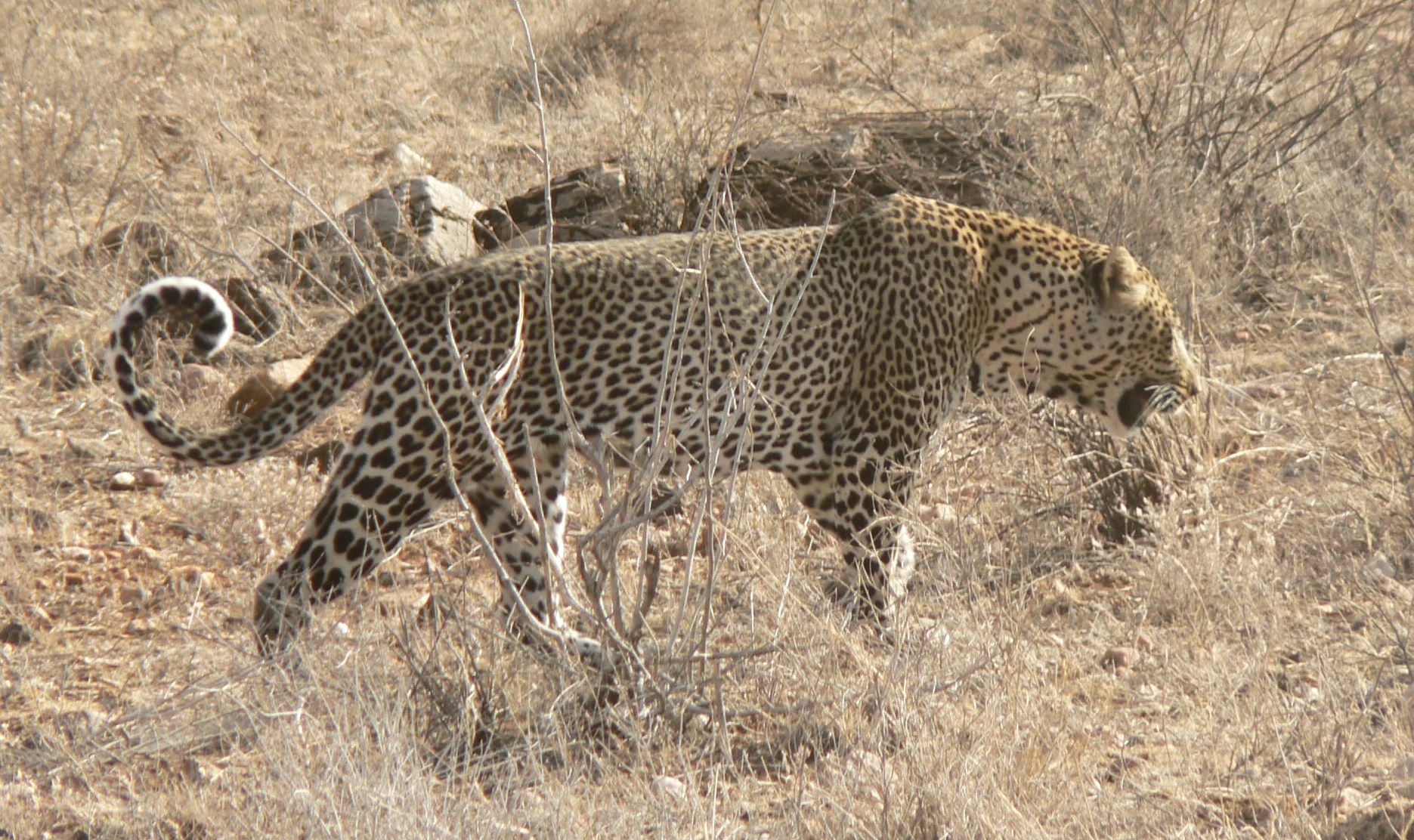
Leopard. Image credit: Wouter Van Viet, Creative Commons
The ecoregion has a rich avifauna. The black-lored babbler is near-endemic, found in the area west of the Okavango Delta and extending into Namibia. The threatened lappet-faced vulture is found throughout the ecoregion.
Much of the ecoregion’s natural vegetation remains intact, and is conserved in several protected areas including part of the Khaudum National Park in Namibia. There are also many community conservancies including Eiseb and Omuramba Ua as well as community forests, Nyae Nyae and Ondjou. In Botswana, the ecoregion extends into the Okavango Delta System Ramsar Site.
The most significant threat to this ecoregion is the expansion of livestock agriculture and overgrazing. This has been made possible by the wide-scale sinking of boreholes to tap into groundwater sources and the elimination of competing wildlife species. Veterinary cordon fences were erected to control the spread of foot and mouth disease to cattle, but pose a major threat to wildlife populations. The networks of fences that cross much of Botswana have disrupted the migratory patterns of a number of large mammals, causing a massive decline in populations of wildebeest, hartebeest, zebra, and buffalo. A significant threat is from climate change which is estimated to increase rainfall variability and the frequency of extreme drought periods.
_-CC-Bernard%20Dupont-2010.jpg)
Common Duiker. Image credit: Bernard Dupont, Creative Commons
The priority conservation actions for the next decade will be to: 1) promote sustainable agricultural and rangeland management practices, for example, rotational grazing and conservation agriculture; 2) promote the development of community forests and conservancies to enable local communities to sustainably manage their natural resources and generate alternative livelihoods; and 3) reassess the need for veterinary fences, remove fences where they are no longer necessary, and implement innovative fence/control design where they are needed for disease control, for example, cattle grids to prevent the passage of buffalo without blocking access by other migratory species such as elephants.
Citations
1. Burgess, N., Hales, J.A., Underwood, E., Dinerstein, E., Olson, D., Itoua, I., Schipper, J., Ricketts, T. and Newman, K. 2004. Terrestrial ecoregions of Africa and Madagascar: a conservation assessment. Island Press.
2. Gadd, M.E. 2012. Barriers, the beef industry and unnatural selection: a review of the impact of veterinary fencing on mammals in Southern Africa. In Fencing for conservation (pp. 153-186). Springer, New York, NY.
3. Government of the Republic of Namibia. 2014. Namibia’s Second National Biodiversity Strategy and Action Plan 2013-2022.Windhoek, Namibia: Ministry of Environment and Tourism.
4. NACSO. 2016. The state of community conservation in Namibia – a review of communal conservancies, community forests and other CBNRM initiatives (2016 Annual Report). Windhoek, Namibia: NACSO.

Subscribe to receive monthly updates on climate solutions, environmental heroes, and the profound beauty and wonder of our shared planet Earth.
