
Mid-Canada Boreal Plains Forests
The ecoregion’s land area is provided in units of 1,000 hectares. The conservation target is the Global Safety Net (GSN1) area for the given ecoregion. The protection level indicates the percentage of the GSN goal that is currently protected on a scale of 0-10. N/A means data is not available at this time.
Bioregion: Mid-Canada Boreal Plains & Foothill Forests (NA8)
Realm: Subarctic America
Ecoregion Size (1000 ha):
56,847
Ecoregion ID:
376
Conservation Target:
66%
Protection Level:
1
States: Canada: MB, SK, AB, BC
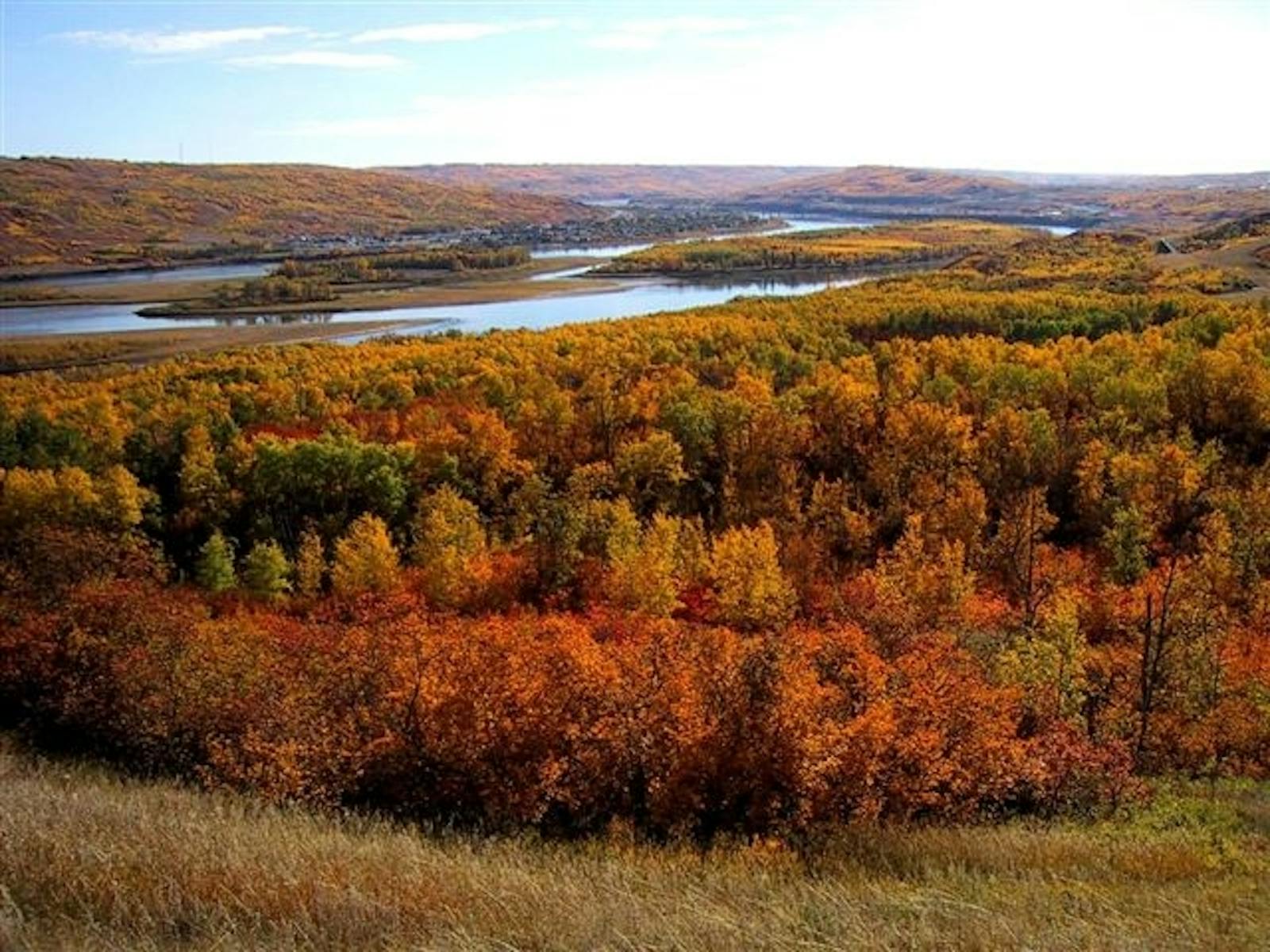
The Mid-Canada Boreal Plains Forests ecoregion spans a large region of Canada, from just south of Wood Buffalo National Park in Alberta southeastward to just north of Winnipeg, Manitoba, encompassing Lake Winnipeg. Its western edge interdigitates with the Alberta-British Columbia Foothills Forests ecoregion. It borders the Muskwa-Slave Lake Taiga ecoregion on the north, the Midwest Canadian Shield Forests ecoregion on the north and east, a small part of the Western Great Lakes Forests ecoregion on the southeast, and the Northern Tallgrass Prairie and Canadian Aspen Forests and Parklands ecoregions on the south.
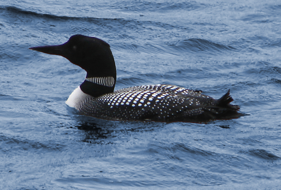
The flagship species of the Mid-Canada Boreal Plains Forests ecoregion is the common loon. Image credit: Creative Commons
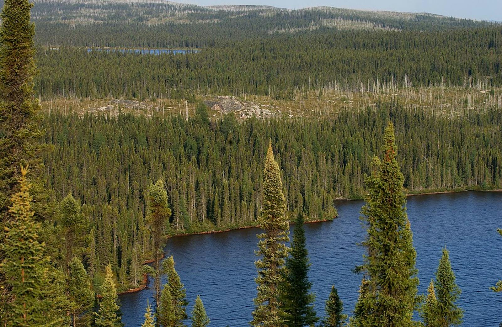
The Mid-Canada Boreal Plains Forests are part of the continuous mid-boreal coniferous and deciduous forests of Canada, which extend from northwestern Ontario to the foothills of the Rocky Mountains. These forests are transitional between temperate forests and grasslands to the south and pure boreal forests to the north. The ecoregion includes both upland and lowland landscapes, with the lowlands underlain by Paleozoic rocks such as limestone and the uplands by younger Cretaceous shales covered by glacial till and lake deposits. Elevation in the uplands ranges from 100 m to over 400 m.
The climate of this ecoregion is subhumid mid-boreal with warm to cool summers and long, cold winters. The average annual temperature ranges from -2ºC to 1ºC, with summer temperatures in the 13ºC to 15.5ºC range and winter temperatures ranging from -17.5ºC to -13.5ºC. Permafrost is discontinuous and confined largely to peatlands. Average annual precipitation ranges from 300 to 625 mm, highest in the southeastern portion of the ecoregion.
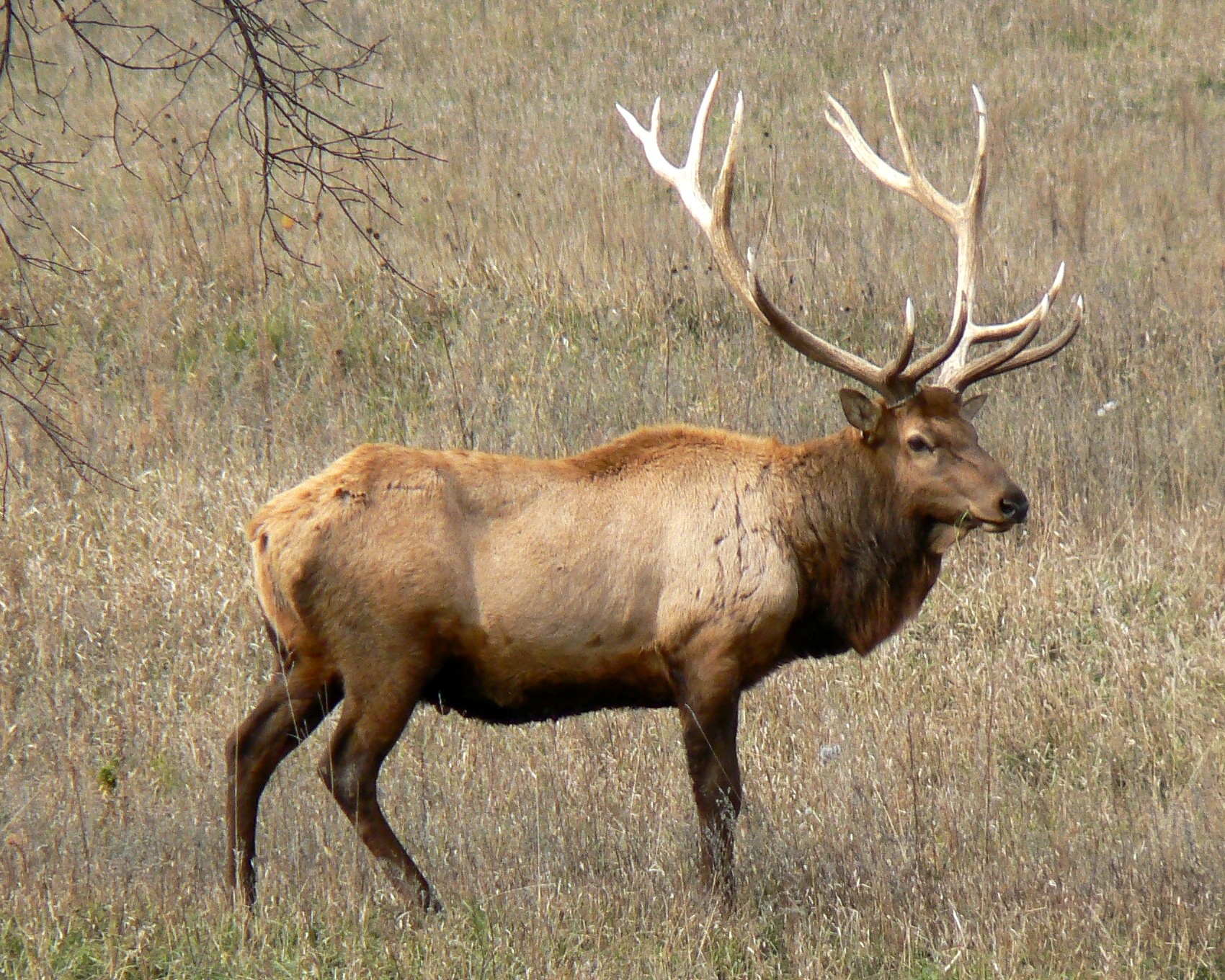
Elk. Image credit: Creative Commons
The dominant vegetation is mixed coniferous and deciduous forest characterized by stands of quaking aspen and balsam poplar mixed with later-successional black spruce, white spruce, and balsam poplar. Wetlands, lakes, and peatlands are abundant, with bogs and fens containing tamarack, black spruce, shrubs in the heath family, and mosses. Lightning fires are relatively frequent and result in a shifting mosaic of deciduous and coniferous stands of varying age. Shrubs and herbs are diverse in deciduous stands, whereas coniferous stands are more moss-dominated.
Characteristic mammals include moose, black bear, wolf, lynx, white-tailed deer, elk, woodland caribou, beaver, snowshoe hare, and muskrat. The interlake plain in the southeastern portion of the ecoregion has moose, coyote, and eastern cottontail. Waterfowl are diverse and abundant, and this ecoregion is a center of abundance for breeding American white pelicans.
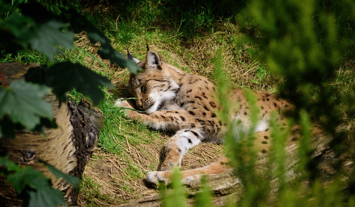
Lynx. Image credit: Matt Wall, Creative Commons
Other characteristic birds include common loon, sandhill crane, ruffed grouse, spruce grouse, northern goshawk, broad-winged hawk, Franklin’s gull, black tern, great gray owl, and many songbirds such as warblers. The number of breeding bird species, and species strongly dependent on boreal forest, in this ecoregion and adjacent ecoregions is the highest in the entire Canadian boreal zone.
A paltry 6% of this ecoregion is protected, but 55% of the area outside protected areas remains in mostly natural condition and offers opportunities for increased protection. Extensive forestry activity with abundant logging roads and clearcuts, however, undermine the integrity of this ecoregion. Other threats include mining and oil and gas production.
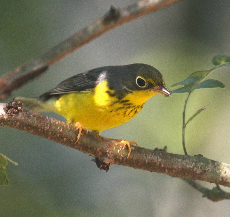
Canada warbler on bough. Image credit: Emmet Hume, Creative Commons
Priority conservation actions for the next decade are to: 1) protect remaining intact blocks of forest, roadless areas, and undeveloped rivers and lakes; 2) greatly increase federal and provincial designation of conservation lands; and 3) improve management of existing conservation lands, especially with respect to fire, carnivores, and ungulates sensitive to hunting pressure.
Citations
1. Ricketts, T.H. et al. 1999. Terrestrial Ecoregions of North America: A Conservation Assessment. Island Press, Washington, D.C.
2. Elliott-Fisk, D.L. 2000. The taiga and boreal forest. In M.G. Barbour and W.D. Billings, editors. North American Terrestrial Vegetation, 2nd edition. Cambridge University Press, Cambridge, U.K.
3. Noss, R.F., K. Bennett, E. Butterworth, C. Francis, A. Couturier, P. Paquet, and K. Vance-Borland. 2002. Conservation Biology for Canada’s Boreal Forest. A project of the Canadian Boreal Trust (Pew Charitable Trusts). Conservation Science, Inc. Corvallis, OR.

Subscribe to receive monthly updates on climate solutions, environmental heroes, and the profound beauty and wonder of our shared planet Earth.
