

Namaqualand-Richtersveld Steppe
The ecoregion’s land area is provided in units of 1,000 hectares. The protection goal is the Global Safety Net (GSN1) area for the given ecoregion. The protection level indicates the percentage of the GSN goal that is currently protected on a scale of 0-10.
Bioregion: Southwest African Coastal Drylands (AT10)
Realm: Afrotropics
Ecoregion Size (1000 ha):
5,304
Ecoregion ID:
102
Conservation Target:
52%
Protection Level:
7
States: South Africa, Namibia
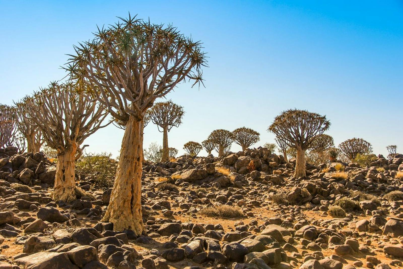
The quiver tree, belonging to the genus Aloe, is essential to the local ecosystem of the Namaqualand-Richtersveld Steppe ecoregion as it provides vital moisture for a range of mammals, birds, and insects. The succulent leaves and stem of the quiver trees have special water-storing tissue, enabling the tree to withstand long periods of drought conditions. The trees inhabit dry, rocky areas and have a life span of approximately 200 years, but they are currently threatened by agricultural expansion, overgrazing, mining, and climate change.
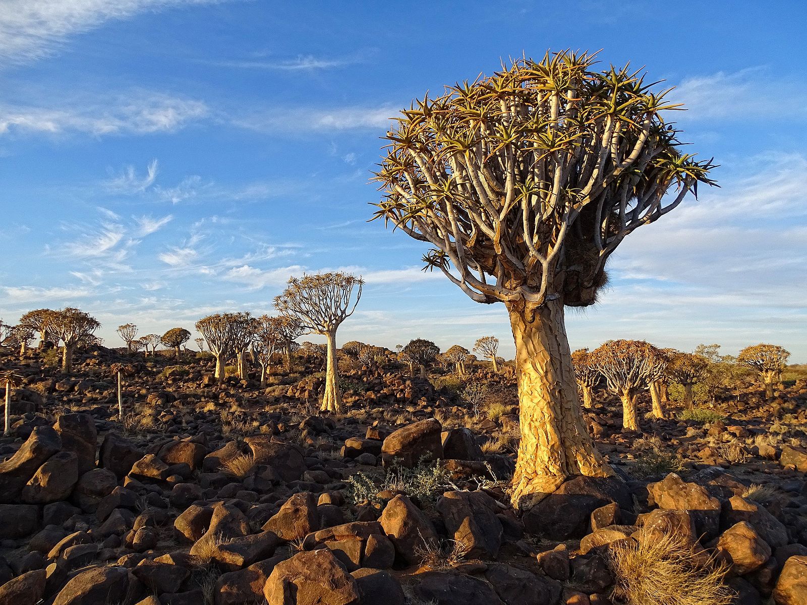
The flagship species of the Namaqualand-Richtersveld Steppe ecoregion is the quiver tree (Aloidendron dichotomum). Image Credit: Wiki Creative Commons.
The ecoregion extends down the western coast of Namibia from the town of Lüderitz and into South Africa. It comprises the major biogeographical domain, the Namaqualand-Namib. The Namaqualand-Namib Domain is part of the Namaqualand Metamorphic Province, comprising granites and gneisses that are from one to two billion years old.
This ecoregion encompasses the fog-affected coastal plain and adjacent escarpment in the west and receives most of its rain in the winter. Rainfall is reliable and predictable, falling mostly in winter, and prolonged winter droughts are rare. The climate is mild compared to other arid areas where frosts are extremely rare. This domain receives annual rainfall ranging from 20 millimeters (.8 in) in the drier northwest to more than 400 millimeters (16 in) in the escarpment zone, but most of the area receives less than 150 millimeters (6 in). Precipitation is supplemented by heavy dewfalls and fog.
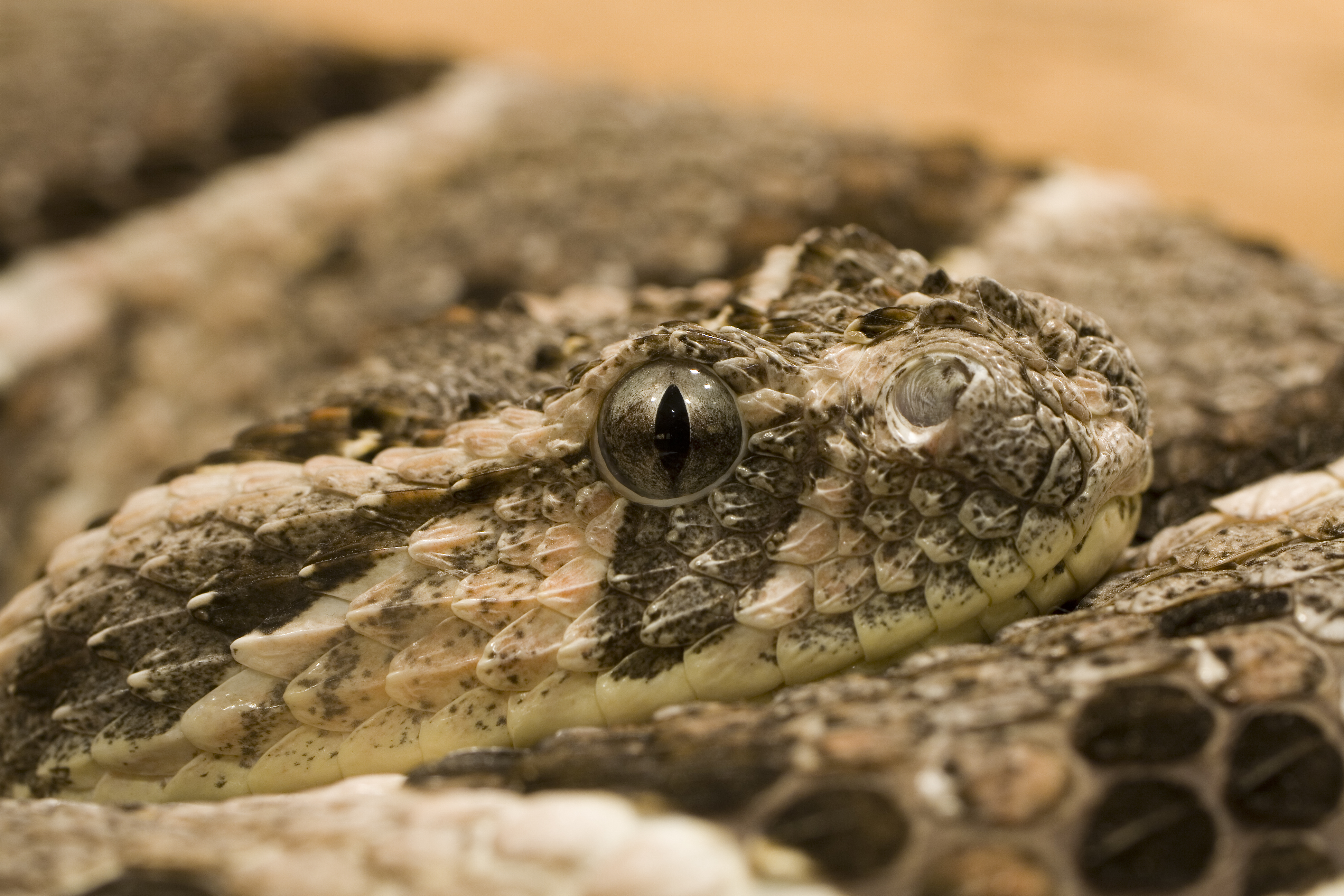
Puff adder (Bitis arietans). Image Credit: Julies Ruckert, Wiki Creative Commons.
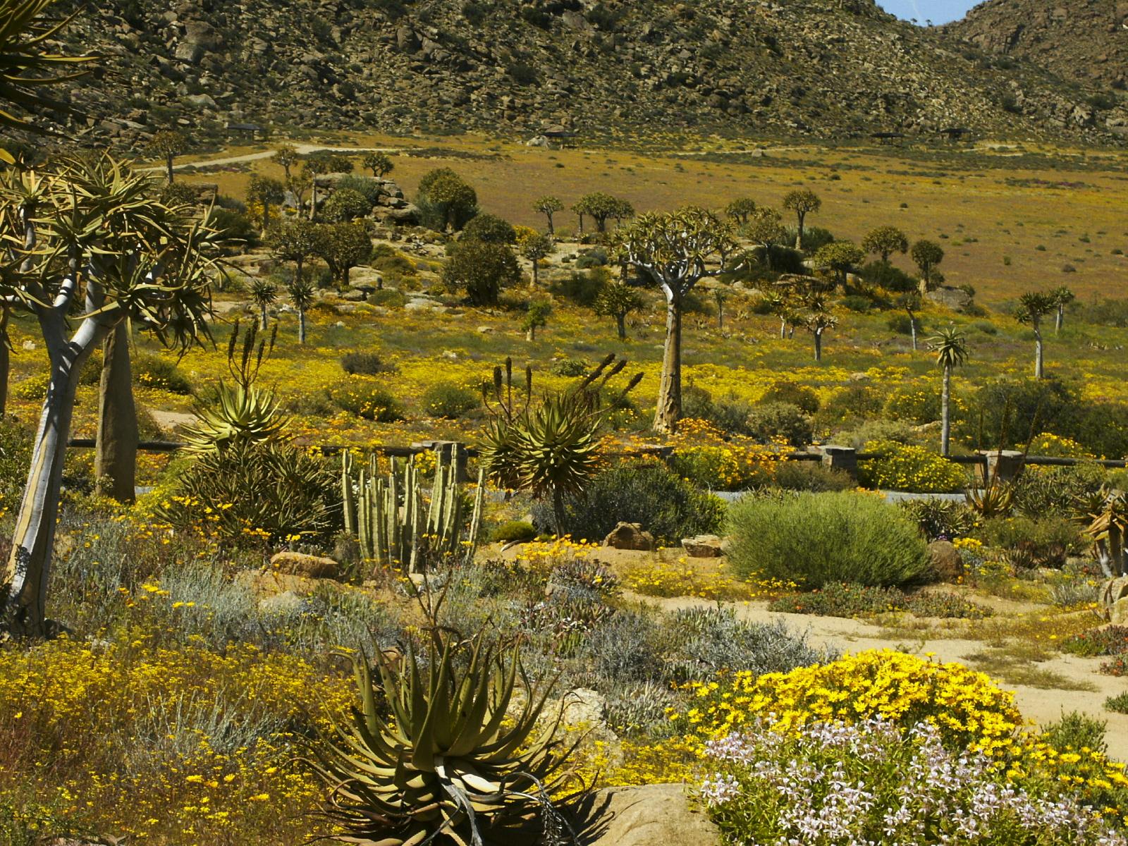
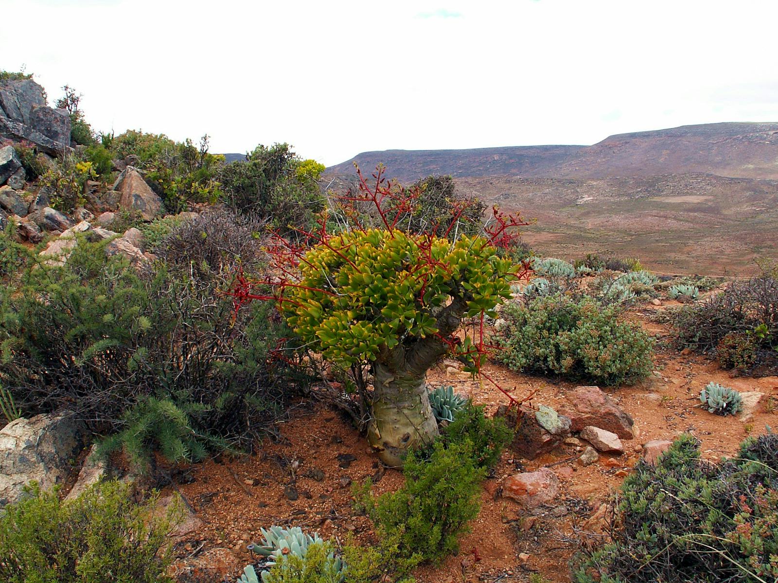
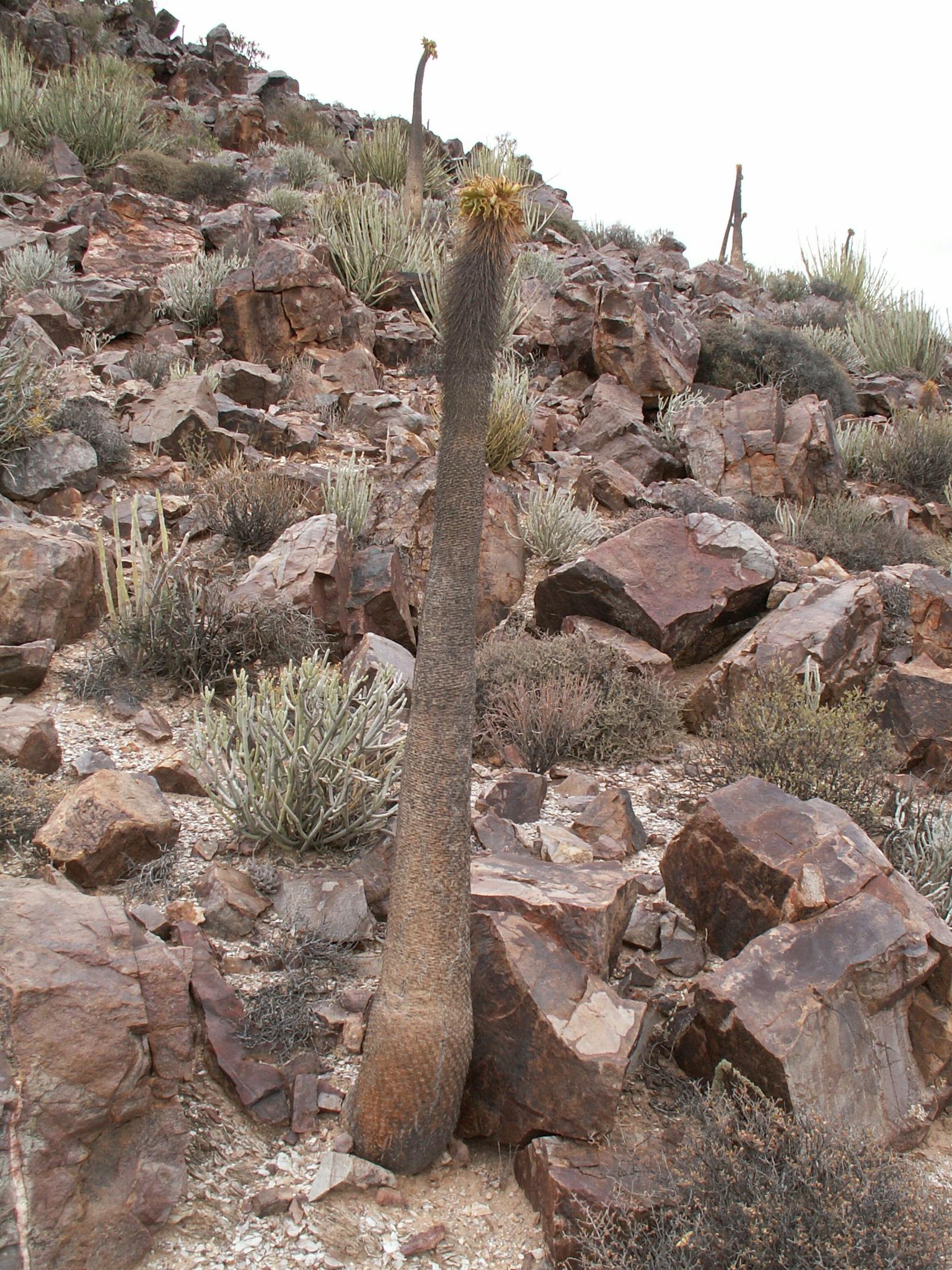
The ecoregion belongs to the world’s only plant hotspot that is entirely arid. By far, the most distinctive feature here is the diversity of succulents, especially dwarf and contracted leaf species. The major families contributing to this group are Mesembryanthemaceae, Crassulaceae, and Aloaceae. Another outstanding feature is the high diversity of geophytes or bulblike plants. Tree richness is poor, comprising only 35 species, but this paucity is offset by the presence of charismatic endemics such as the bastard quiver tree, quiver tree, and halfmens. Levels of plant endemism are extremely high. The Gariep Centre encompasses the Richtersveld and extends northwards into Namibia’s Sperrgebiet.
This area is home to about 355 endemic plant species and three endemic genera, namely Juttadinteria, Dracophilus, and Arenifera. Included in this center are lichen fields that have the highest cover, density, and diversity of lichens in the world. The fauna of the ecoregion has a rich complement of endemics, especially among the arachnids, hopliniid beetles, aculeate Hymenoptera, and reptiles. Among the region’s reptiles, endemics include Namaqua thick-toed gecko and Meyer’s legless skink. Endemism is less pronounced among the bird and mammal faunas. Of the birds, only one is strictly endemic, Barlow’s lark, which occurs only in the Sperrgebiet region.
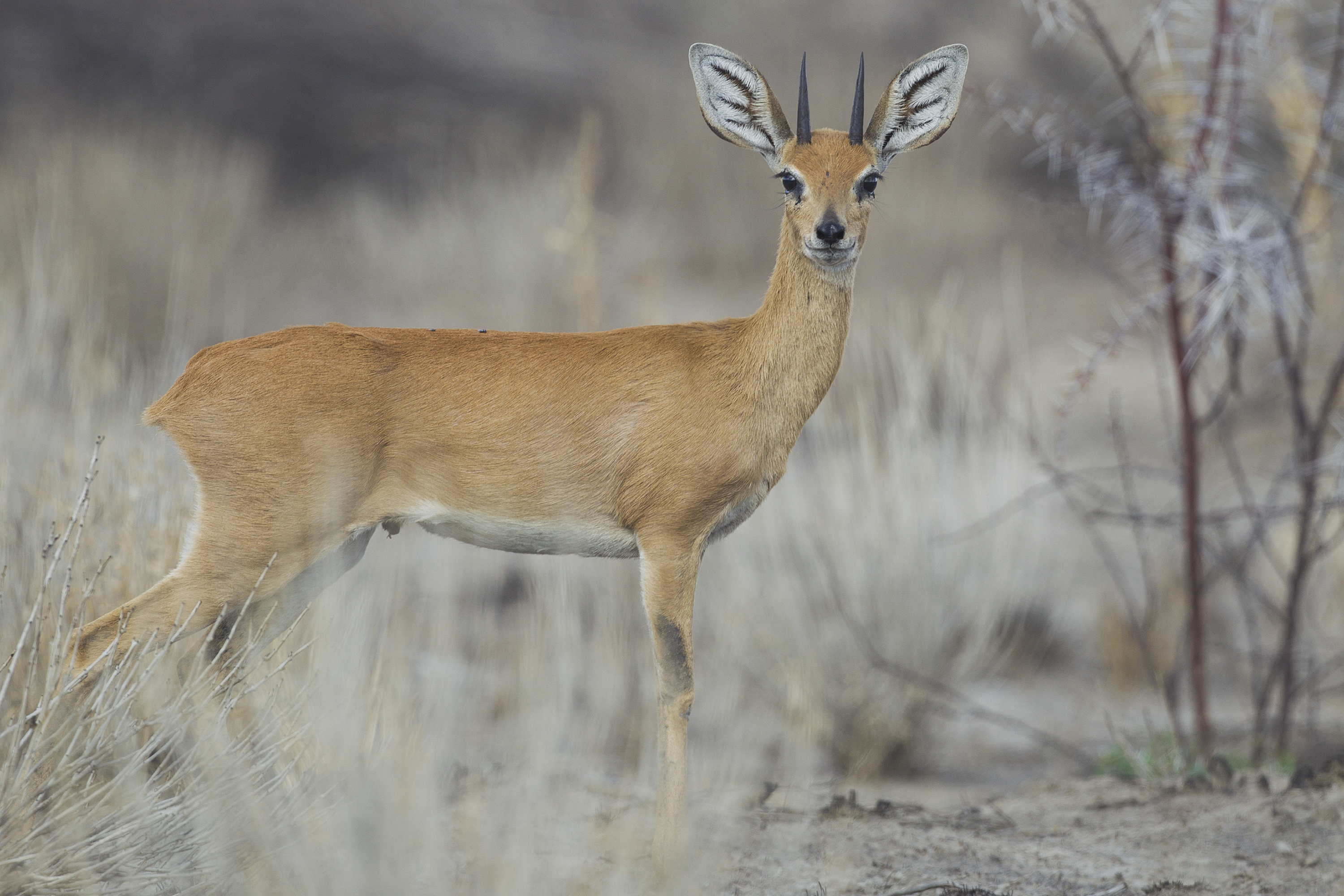
Steenbok (Raphicerus campestris). Image Credit: Yathin S Krishnappa, Wiki Creative Commons.
Large tracts of the ecoregion are still fairly intact in spite of general overgrazing. Large areas of the higher and, hence, wetter areas of the Namaqualand-Namib Domain have also been converted for agriculture. Formal reserves include the Richtersveld National Park, where nomadic herders graze livestock, Ai-Ais Hot Springs National Park, Namaqua National Park, and the Goegab Nature Reserve. The Sperrgebiet National Park is enclosed in a Protected Diamond Area, which has been closed to the public since 1910, with the lease expiring in 2020. This has resulted in large tracts of unspoiled dune and mountain landscapes and is considered a wilderness area. The main mining area is the narrow coastal belt covering about one percent of the Sperrgebiet with impacts leading to excessive inland sand movement.
Although much of the ecoregion is in a natural or semi-natural state, much of the habitat has been severely degraded by over-grazing. Land-use practices that will further threaten the ecoregion’s biodiversity include the expansion of communally-owned and privately-owned rangeland; agriculture, especially in the valleys of perennial rivers; illegal and large-scale collection of succulents and geophytes as well as mining for diamonds, heavy minerals, gypsum, limestone, marble, monzite, kaolin, ilmenite, and titanium which has transformed the entire coastline and encroaches on the fragment patches of dune and coastal shrubland. In addition, climate change is likely to have a major negative influence on the biodiversity of the ecoregion, given the specialized habitat requirements of the numerous local and point plant endemics.
The priority conservation actions for the next decade
1) It is essential to expand the protected area network, ensuring there is connectivity between parks and reserves to facilitate the movement and genetic diversity of wildlife.
2) There is a need to support mining companies in developing and implementing policies that effectively address and mitigate impacts on biodiversity.
3) To safeguard regions of high biodiversity value, it is crucial to implement exclusion zones within protected areas, strictly limiting mining and other developmental activities in these sensitive ecosystems.
-
-
1. Burgess, N., Hales, J.A., Underwood, E., Dinerstein, E., Olson, D., Itoua, I., Schipper, J., Ricketts, T. and Newman, K. 2004. Terrestrial ecoregions of Africa and Madagascar: a conservation assessment. Island Press.
2. CEPF. 2003. Ecosystem Profile: The Succulent Karoo Hotspot. Namibia and South Africa. [Online]. [Accessed 20 April 2018]. Available from: https://www.cepf.net/sites/default/files/final.succulentkaroo.ep_.pdf
3. Guo, D., Arnolds, J.L., Midgley, G.F. and Foden, W.B. 2016. Conservation of quiver trees in Namibia and South Africa under a changing climate. Journal of Geoscience and Environment Protection. 4(07), pp.1-8.
4. Burke, A. 2017. New plant distribution records for southern Namibia. Bothalia-African Biodiversity & Conservation. 47(1), pp.1-6. -
Cite this page: Namaqualand-Richtersveld Steppe . Ecoregion Snapshots: Descriptive Abstracts of the Terrestrial Ecoregions of the World, 2021. Developed by One Earth and RESOLVE. https://www.oneearth.org/ecoregions/namaqualand-richtersveld-steppe/
-

Subscribe to receive monthly updates on climate solutions, environmental heroes, and the profound beauty and wonder of our shared planet Earth.
