

Nyanga-Chimanimani Montane Forest-Grassland
The ecoregion’s land area is provided in units of 1,000 hectares. The conservation target is the Global Safety Net (GSN1) area for the given ecoregion. The protection level indicates the percentage of the GSN goal that is currently protected on a scale of 0-10. N/A means data is not available at this time.
Bioregion: Greater African Subequatorial Savannas & Mixed Woodlands (AT11)
Realm: Afrotropics
Ecoregion Size (1000 ha):
775
Ecoregion ID:
85
Conservation Target:
13%
Protection Level:
9
States: Zimbabwe, Mozambique
The discovery of gold in the Chimanimani Mountains saw thousands of artisanal miners flooding to the region in the mid-2000s to reap the benefits. The damage of gold panning can be seen from satellites, revealing huge destruction of river beds and banks. Moreover, the largely unseen, but significant degradation of water quality has resulted in aquatic species suffering as a result of this.
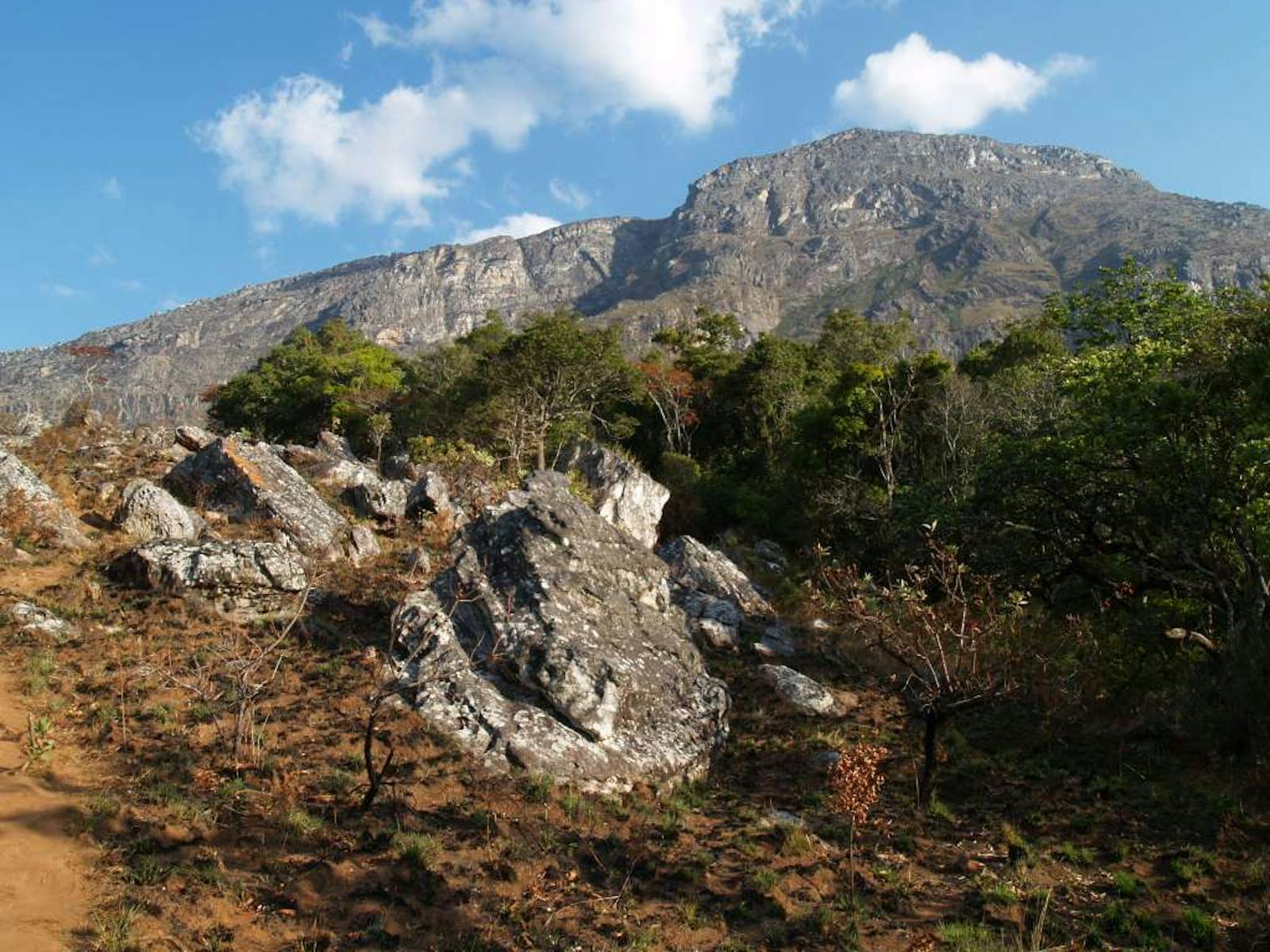
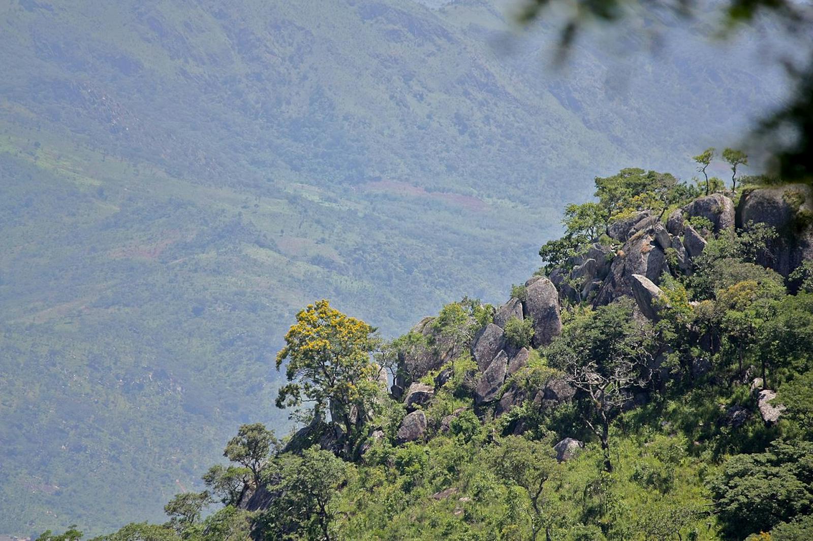
The ecoregion covers the mountains that extend along the border between Zimbabwe and Mozambique. The entire ecoregion is over 1,000 m in elevation with a maximum elevation of 2,592 m on the Nyangani Massif in the north and 2,400 m in the Chimimimani Mountains. Habitats comprise montane grassland and ericaceous shrubland, with patches of montane, submontane, medium altitude, and lowland moist evergreen forests. The differences in vegetation result from variation in altitude, water availability (particularly during the dry season), anthropogenic disturbance, and to a lesser degree soil, aspect, and topography.
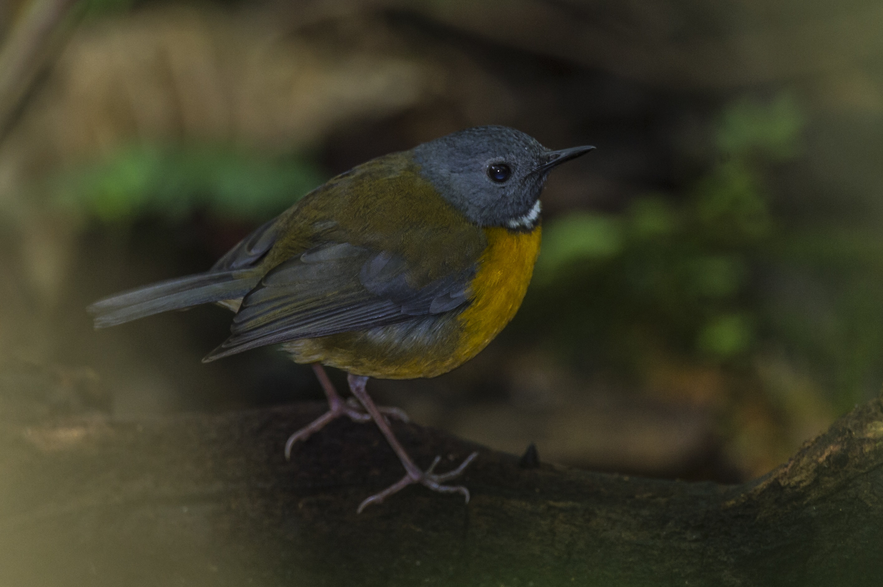
The flagship species of the Nyanga-Chimanimani Montane Forest-Grassland ecoregion is the Swynnerton's robin. Image credit: Creative Commons
Annual rainfall in the ecoregion varies from 741 mm to 3,000 mm per year, largely related to differences in aspect. Most of the rain falls in the austral summer months from November to April, while the austral winter months from May to July are drier. Windward slopes of the highlands extract moisture from the air, which condenses into rain, low clouds, or mist. The mists are especially important in allowing forest to persist during the dry season. Annual mean temperatures range from a minimum of 9°C to 12°C to a maximum of 25°C to 28°C.
The forests of this ecoregion form part of the Afromontane archipelago-like regional center of endemism. This ecoregion supports relatively high plant species richness as a result of the complex mosaic of different vegetation types. There are at least two endemic mammals in this ecoregion, the Arend's golden mole and the Silinda rock rat. Characteristic forest species include African palm civet, mutable sun squirrel and greater galago. Leopards are found throughout this ecoregion, moving between the different vegetation types.
The more open grasslands and heathlands contain fewer mammal species, with the klipspringer, sable antelope, eland and rock hyrax being the most conspicuous. A rich and varied bird life is found, including the strictly endemic Chirinda apalis and Roberts’ prinia, as well as the globally threatened Swynnerton's robin.
The higher altitude vegetation types are relatively well protected. The Chimanimani National Park (171 km2) includes representative portions of all vegetation types in the ecoregion. In particular, it conserves significant areas of high-elevation heathland vegetation. The Nyanga National Park (330 km2) covers habitats between 1,500 m and 2,100 m altitude, including both montane grassland and forest.
The Mozambique side of the Chimanimani Mountains is less protected, and Mount Gorongosa is presently protected under Coutada Official No.13 hunting reserve. There are many state forests including Tandai, York, and Martin. The Chimanimani Transfrontier Conservation Area was established to conserve the biodiversity of the highland ecosystem.
The most threatened areas are the lower and medium elevation moist evergreen rain forests. These forests grow on fertile, well-watered slopes that are ideal for farming. Much of the former forest vegetation has already been cleared for tea and coffee plantations and for dairy farming. There are still patches of unprotected forest that could also be lost to agriculture.
On the disturbed margins of the forest at medium altitudes, exotics such as Lantana camara, Mauritius thorn, wattle, and eucalyptus species are invading. Threats to Chirinda Forest include poaching (particularly for blue duiker and guineafowl), the collection of firewood and the gathering of traditional herbal medicines. The high altitude montane forests, grasslands, woodlands and heathlands face fewer threats. They are restricted to areas that are not suitable for farming, and have a low human population density.
However, invasion by exotic trees, such as wattle and pine, is an increasing problem. Another threat is from fires for illegal hunting, land clearing for agriculture, particularly in Nyanga National Park. A growing threat is from increasing temperatures and erratic rainfall caused by climate change.
The priority conservation actions for the next decade will be to: 1) develop fire management plans and promote awareness of wildlife and fire management in local communities; 2) support capacity building of eco-tourism livelihood initiatives to provide an alternative livelihood to gold mining; and 3) promote conservation agriculture to sustainably increase agricultural productivity as well as mitigating the effects of climate change in the long term.
Citations
1. Burgess, N., Hales, J.A., Underwood, E., Dinerstein, E., Olson, D., Itoua, I., Schipper, J., Ricketts, T. and Newman, K. 2004. Terrestrial ecoregions of Africa and Madagascar: a conservation assessment. Island Press.
2. Zisadza-Gandiwa, P., Gandiwa, E., Matokwe, T.B., Gwazani, R., Mashapa, C., Muboko, N. and Mudangwe, S. 2014. Preliminary assessment of vegetation fires and their impact in Nyanga National Park, Zimbabwe. Greener Journal of Biological Sciences. 4, pp.009-17.
3. Southern African Development community. 2015. Chimanimani Transfrontier Conservation Area. [Online]. [Accessed 14 March 2018]. Available from: https://www.giz.de/en/downloads/giz2015-en-tfca-chimanimani.pdf
4. Marongwe, L.S., Kwazira, K., Jenrich, M., Thierfelder, C., Kassam, A. and Friedrich, T. 2011. An African success: the case of conservation agriculture in Zimbabwe. International journal of agricultural sustainability. 9(1), pp.153-161.

Subscribe to receive monthly updates on climate solutions, environmental heroes, and the profound beauty and wonder of our shared planet Earth.
