
Ogilvie-Mackenzie Alpine Tundra
The ecoregion’s land area is provided in units of 1,000 hectares. The protection goal is the Global Safety Net (GSN1) area for the given ecoregion. The protection level indicates the percentage of the GSN goal that is currently protected on a scale of 0-10.
Bioregion: Greater Yukon (NA6)
Realm: Subarctic America
Ecoregion Size (1000 ha):
30,171
Ecoregion ID:
419
Conservation Target:
100%
Protection Level:
1
States: United States: AK. Canada: YT, NT
The Ogilvie-Mackenzie Alpine Tundra ecoregion is an extremely steep and rugged mountain ecoregion of northwestern Canada and a small part of Alaska. The ecoregion encompasses the Ogilvie and Wernecke Mountains in the north, the Backbone Ranges, the Canyon Ranges, the Selwyn Mountains, and the eastern and southern Mackenzie Range—the last two ranges often considered a northern extension of the Rocky Mountains.
The ecoregion is bounded on the east by the Northwest Territories Taiga, on the southeast by the Muskwa-Slave Lake Taiga, on the south and west by the Watson Highlands Taiga, also on the west by the Interior Yukon-Alaska Alpine Tundra, on the northwest by the Interior Alaska-Yukon Lowland Taiga, and on the north by the Brooks-British Range Tundra ecoregion.
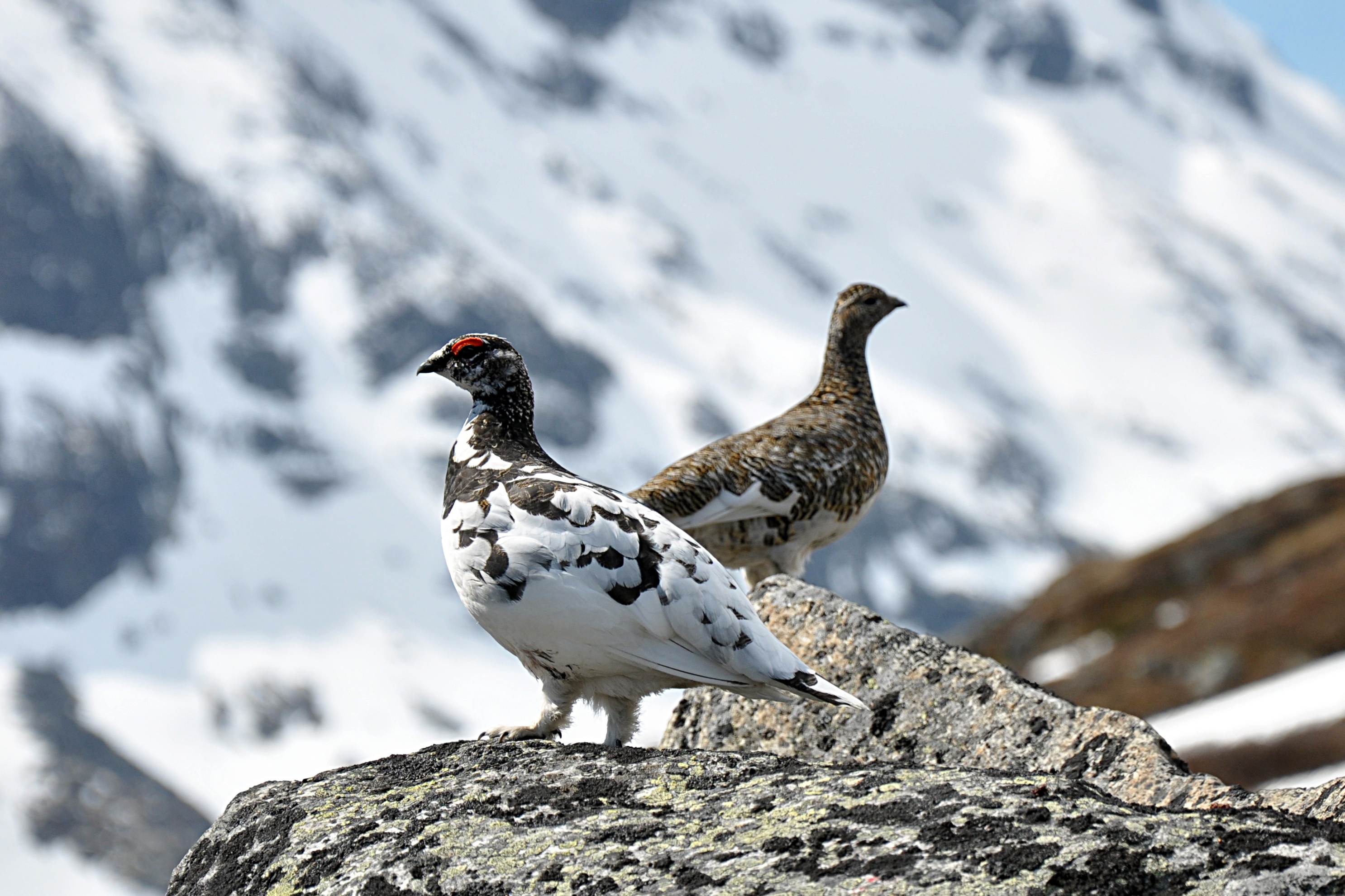
The flagship species of the Ogilvie-Mackenzie Alpine Tundra ecoregion is the rock ptarmigan. Image credit: Creative Commons
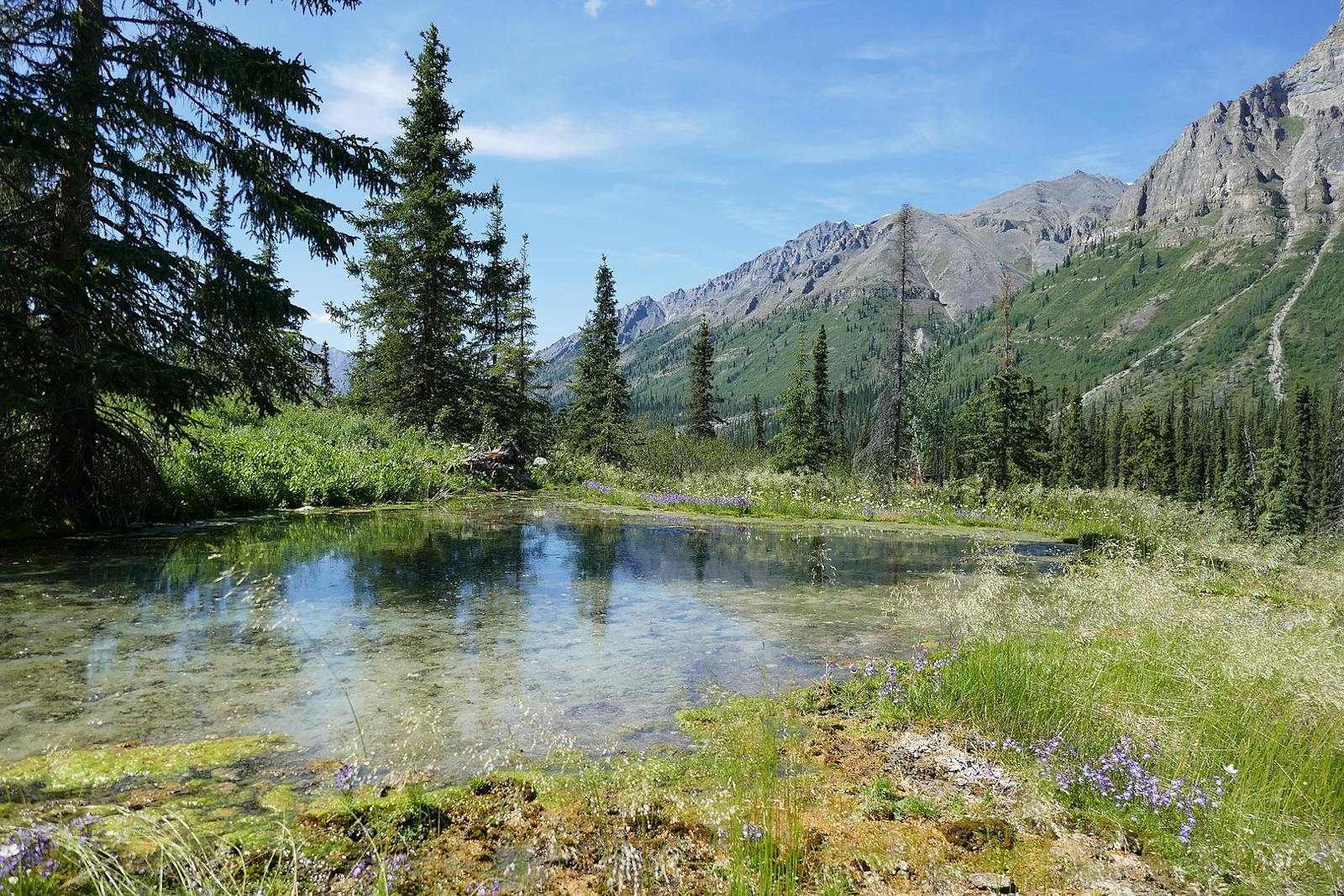
Most of the region was glaciated, but unglaciated areas occur in the north. Alpine and valley glaciers are still common in the ecoregion. The bedrock is mostly sedimentary, with frequent exposed bedrock and abundant bare talus slopes. Elevations generally increase southward, from 900–1,800 m in the north to more than 2,100 m in the central portion and with peaks to 2,950 m in the south.
The climate of this ecoregion is subalpine to alpine northern subarctic cordilleran, with permafrost extensive and often continuous. Summers are cool and winters long and cold. Average summer temperatures range from around 9ºC to 9.5ºC and average winter temperatures from -21.5ºC in the north to -19.5ºC in the south. Temperatures of -50ºC in winter are not rare. Precipitation is quite variable, but generally increases from northwest to southeast, from 300 mm to around 600 mm, peaking at around 750 mm at high elevations of the Selwyn Mountains.
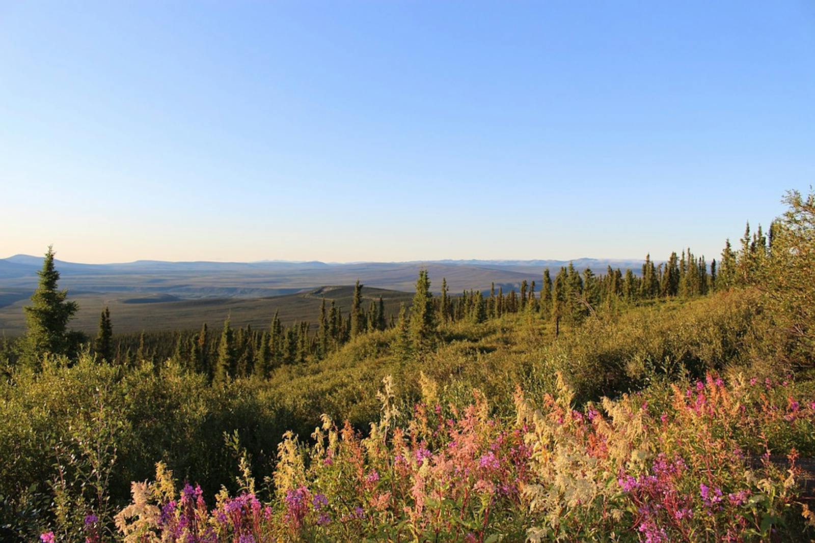
The distinctive vegetation of the region is open subalpine woodland at lower elevations and alpine tundra at higher elevations. The woodland is dominated by discontinuous stands of white spruce, with occasional subalpine fir and lodgepole pine, in a matrix of dwarf birch and northern Labrador tea. Paper birch can form extensive stands at low elevations and midslope positions in the north but is less common southward and eastward. The alpine tundra consists of lichens, mountain avens, dwarf to intermediate shrubs in the heath family, and sedges, especially cottongrass in wetter sites.
Some characteristic mammals of the ecoregion are caribou, wolf, wolverine, grizzly and black bear, red fox, Dall sheep, moose, beaver, Arctic ground squirrel, and snowshoe hare. This ecoregion is important for providing winter range to the Porcupine caribou herd and year-round range for the Bonnet-Plume caribou herd. Birds include common raven, rock and willow ptarmigan, bald eagle, golden eagle, gyrfalcon, peregrine falcon, yellow rail, red-necked grebe, and trumpeter swan.
The Ni'iinlii'njik (Fishing Branch) River’s limestone geology allows relatively warm groundwater to resurface in the river and remain unfrozen year-round. The salmon run here is in the autumn, rather than the summer, as is typical for this latitude. This run attracts the largest concentration of grizzly bears of anywhere at this latitude.i Other fishes in the ecoregion include Arctic grayling, burbot, lake trout, lake chub, lake whitefish, longnose sucker, mountain whitefish, and northern pike. The unglaciated area in the northern part of the ecoregion apparently served as a refugium for some Pleistocene species.
A mere 13% of this ecoregion is protected, but 86% of the ecoregion outside protected areas remains intact and offers opportunities for conservation action. Significant existing protected areas are Ni'iinlii'njik (Fishing Branch) Territorial Park, Nááts'ihch'oh National Park Reserve, and Nahanni National Park Reserve. Although this ecoregion is almost entirely intact, mining and associated road development have altered some areas, even within protected areas.
Priority conservation actions for the next decade are: 1) bring much more land into protection across the ecoregion; 2) prohibit incompatible uses, including mining, within designated protected areas; and 3) protect vulnerable species from over-harvest and monitor populations.
Citations
1. Ricketts, T.H. et al. 1999. Terrestrial Ecoregions of North America: A Conservation Assessment. Island Press, Washington, D.C.
2. Ecological Stratification Working Group. 1995. A National Ecological Framework for Canada. Environment Canada and other agencies, Ottawa.
3. Nahanni National Park Reserve. https://en.wikipedia.org/wiki/Nahanni_National_Park_Reserve

Subscribe to receive monthly updates on climate solutions, environmental heroes, and the profound beauty and wonder of our shared planet Earth.
