
Puerto Rican Moist Forests
The ecoregion’s land area is provided in units of 1,000 hectares. The conservation target is the Global Safety Net (GSN1) area for the given ecoregion. The protection level indicates the percentage of the GSN goal that is currently protected on a scale of 0-10. N/A means data is not available at this time.
Bioregion: Caribbean Islands (NT26)
Realm: Central America
Ecoregion Size (1000 ha):
754
Ecoregion ID:
495
Conservation Target:
76%
Protection Level:
1
States: Puerto Rico
The raucous call of the Puerto Rican amazon was once ubiquitous with the rainforests of this island. However, today the chorus of coqui frogs is more common to hear. This is the only native species of parrot in the Puerto Rican archipelago, with both a distinctive call and feathers with blue wings and a bright green body. Today they are restricted to the primary forest of the Luquillo Mountains in El Yunque National Forest. The Puerto Rican amazon is extremely important to the future of the forests on the island as they are an important seed disperser and are able to spread seeds over long distances as they flay back and forth between forest fragments.
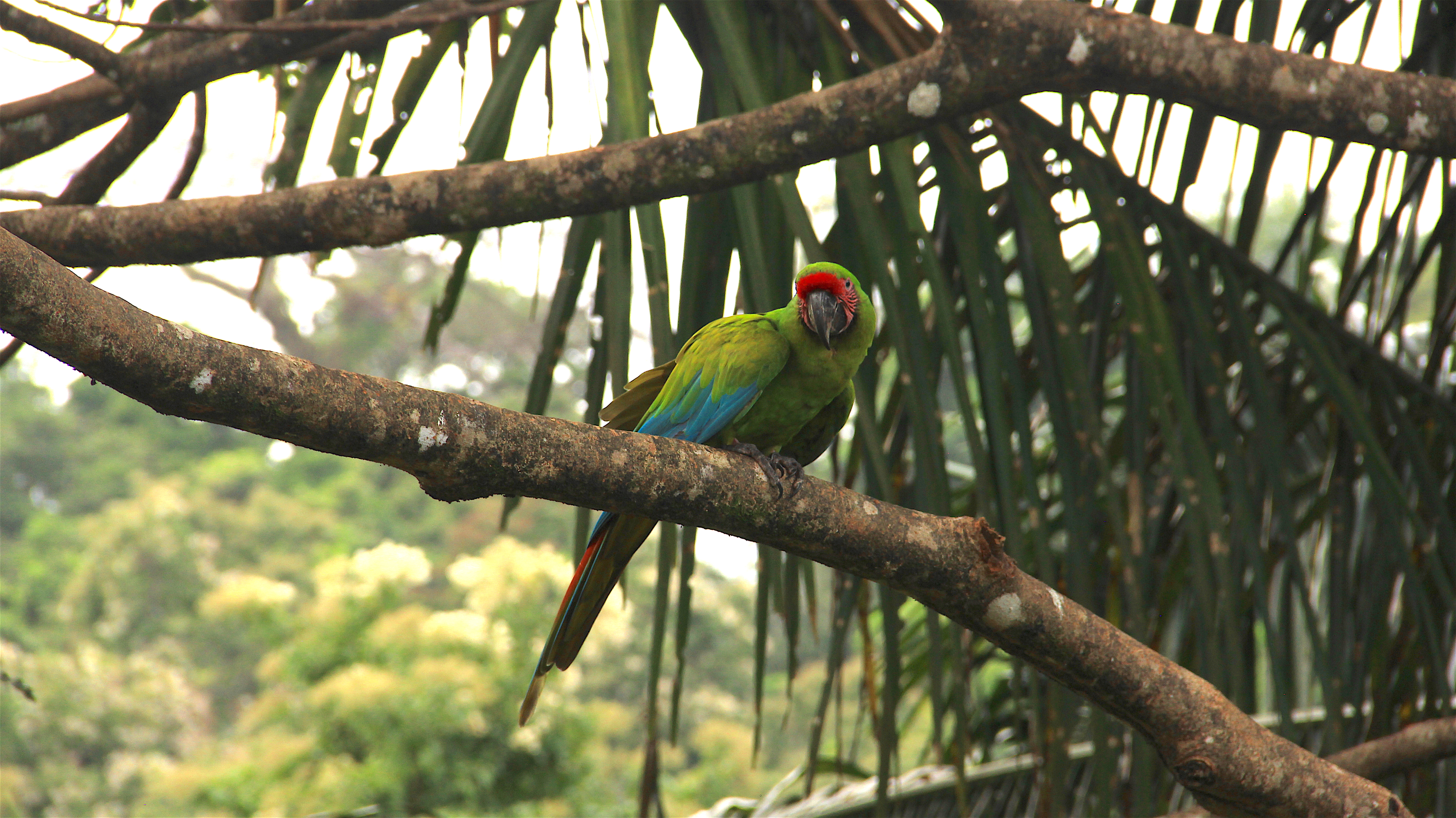
The flagship species of the Puerto Rican Moist Forests ecoregion is the Puerto Rican amazon.
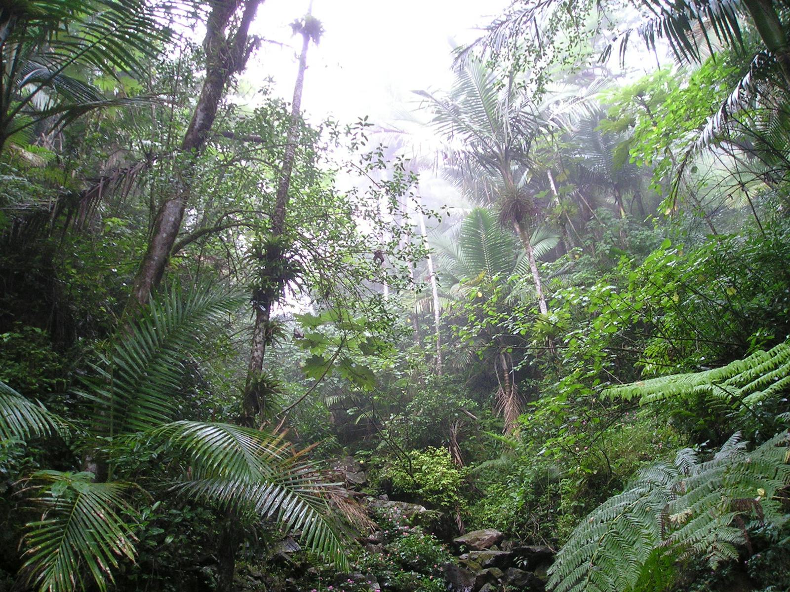
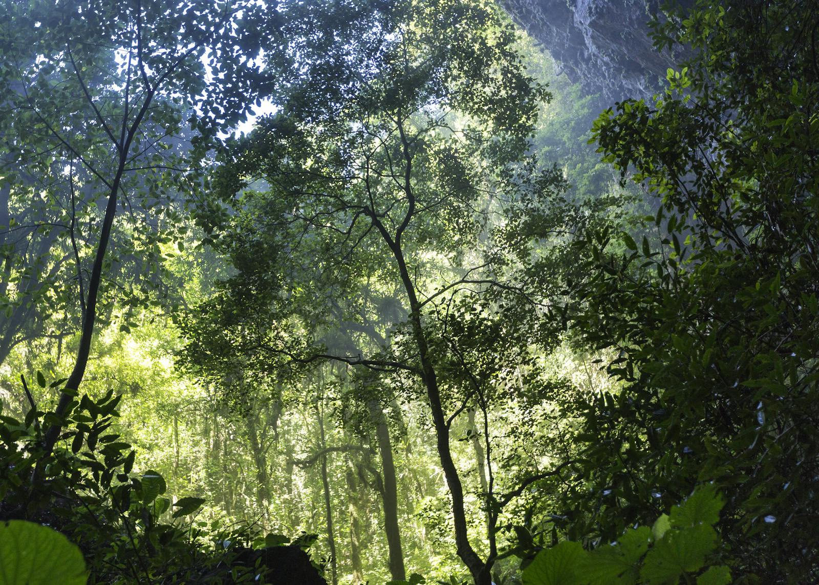
The island of Puerto Rico, like many other Caribbean islands, has a wet and a dry side due to the influence of trade winds and topography. The northern 3/4 of Puerto Rica (roughly 7,500 km2) and parts of the adjacent islands such as Mona, Vieques, Culebra, Desecheo, and Caja de Muertos are tropical moist forest. These wet forests transition to dry forests in the south, and although they share some species their ecosystems are quite unique. The Puerto Rican moist forests are characterized by a warm and wet climate year-round with an average temperature of 26°C. The coolest month is January with an average low of 21°C and an average high of 28°C.
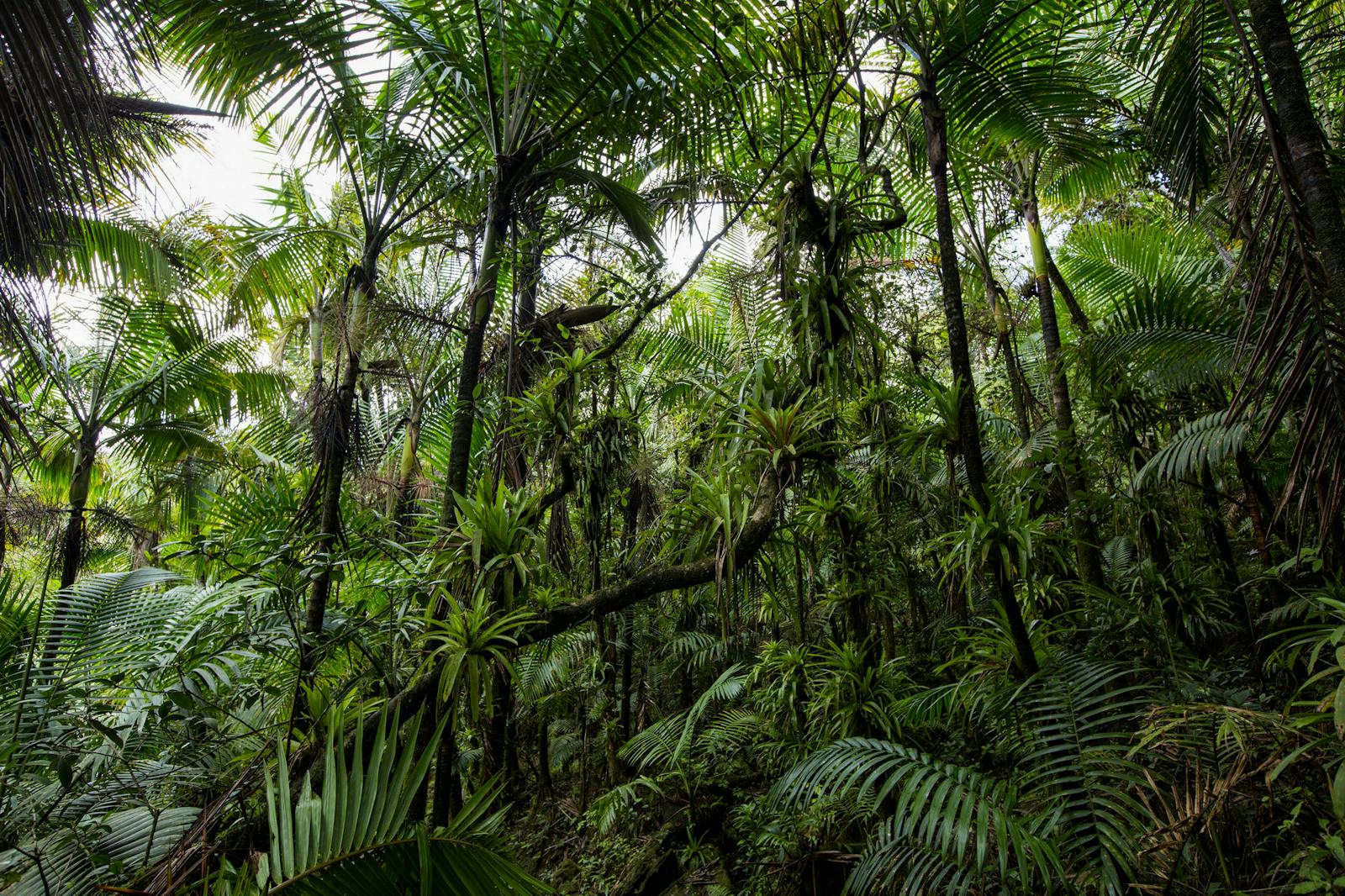
As with most mountainous areas, the forest types (species composition) change with elevation, exposure, and rock type, including lowland forests along the coast and montane forest in the central mountain range (including Sierra de Luquillo). Lowland forests are found throughout the island's coastal lowlands except for the dry southern coastline. Characteristic tree species include Hymenaea courbaril, Coroso palm (Acrocomia media), Nectandra coriacea, and Zanthoxylum martinicense. Trees reach a height of 24 m in the northern coastal lowlands and several species are adapted to dry periods by being deciduous or semi-deciduous.
Montane forests cover the Sierra de Luquillo and the higher peaks of the Cordillera Central. Trees at middle elevations reach a height of 34 m and a diameter of 2.5 m. Common trees of the Sierra de Luquillo include Cyathea arborea, Prestoea acuminata, Cecropia peltata, and Ocotea species. Weinmannia pinnata, Brunellia comocladifolia, and Podocarpus coriaceus are found in the cloud forests of the highest peaks.
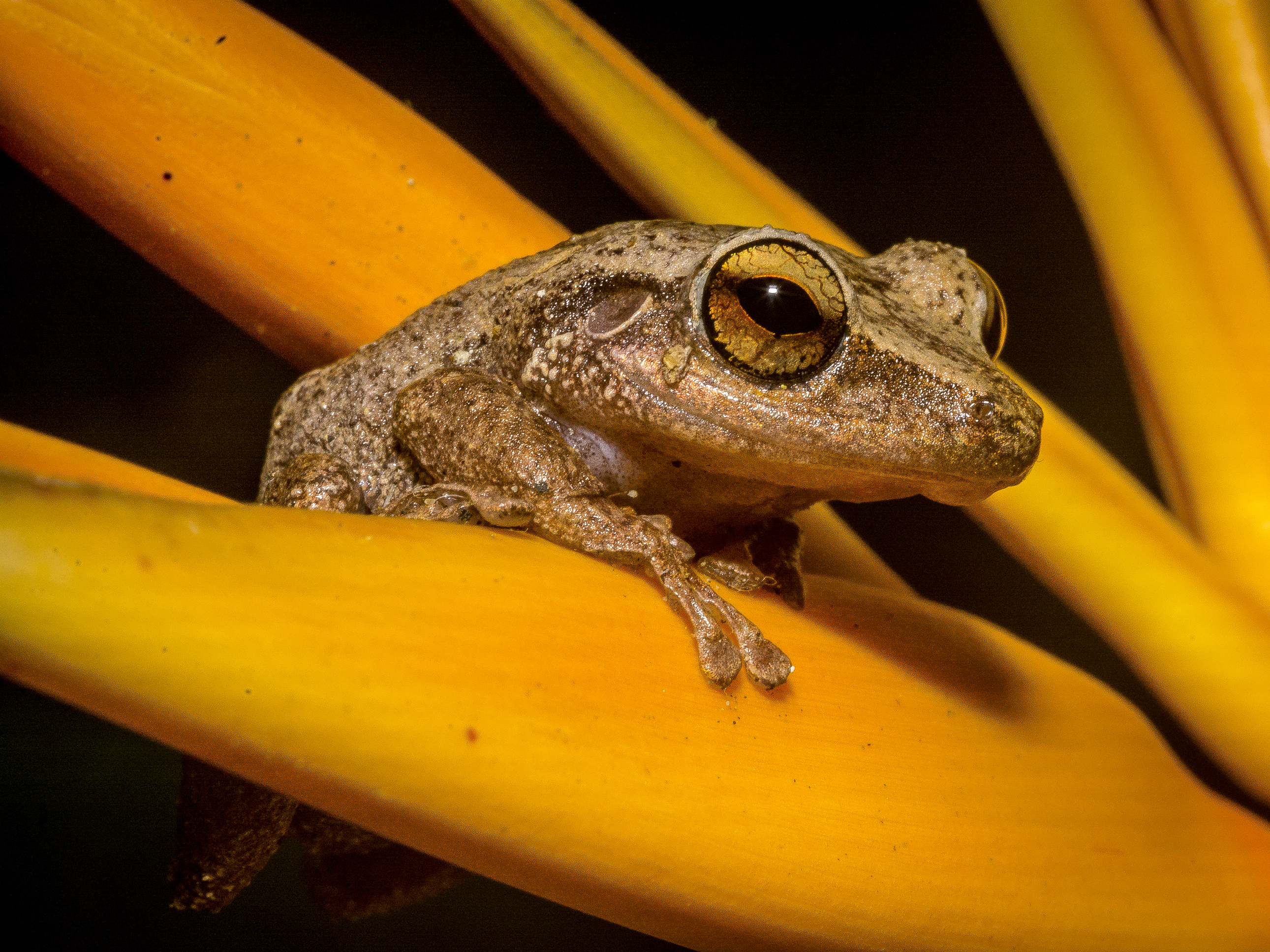
A coqui frog in Puerto Rico. Image credit.
A 2017 assessment found that over 400 km² (5%) of the ecoregion is retained in protected areas, including El Yunque National Forest, Cambalache Forest Reserve, Maricao State Forest, Monte Choca State Forest, Río Abajo State Forest, and Toro Negro State Forest.
This ecoregion includes much of the human population of the island and thus has been reduced over the bast century to make room for food production and urbanization. Although the ecoregion has in many ways been shaped by annual hurricane cycles, with so little forest remaining erosion has become a major problem since much of the forest remaining is on steep slopes where access is difficult. The increase in hurricane activities in the past decade has not only taken a major toll of humans, but floods and landslides also have had an impact of remaining habitat. As with most islands, invasive species are a problem both for humans (crop damage) and for native wildlife.
The priority conservation actions for the next decade will be to: 1) increase resilience of remaining forest to hurricanes and other stochastic events, including erosion prevention; 2) develop more programs to link livelihoods and education programs to forest health and biodiversity, especially surrounding and between protected areas; and 3) increase staffing levels and effectiveness of the protected areas.
Citations
- Olson, D. (1999). Taylor H. Ricketts (ed.). Terrestrial Ecoregions of North America: a Conservation Assessment. Island Press. p. 152. ISBN 978-1-55963-722-0
- Eric Dinerstein, David Olson, et al. (2017). An Ecoregion-Based Approach to Protecting Half the Terrestrial Realm, BioScience, Volume 67, Issue 6, June 2017, Pages 534–545.
- Weaver, P.L., 2012. The Luquillo mountains: forest resources and their history. General Technical Report-International Institute of Tropical Forestry, USDA Forest Service, (IITF-GTR-44).

Subscribe to receive monthly updates on climate solutions, environmental heroes, and the profound beauty and wonder of our shared planet Earth.
