

Sudd Flooded Grasslands
The ecoregion’s land area is provided in units of 1,000 hectares. The conservation target is the Global Safety Net (GSN1) area for the given ecoregion. The protection level indicates the percentage of the GSN goal that is currently protected on a scale of 0-10. N/A means data is not available at this time.
Bioregion: West Sudanian Savanna (AT20)
Realm: Afrotropics
Subrealm: Sub-Saharan Afrotropics
Ecoregion Size (1000 ha):
18,933
Ecoregion ID:
74
Conservation Target:
27%
Protection Level:
8
States: South Sudan, marginally in Ethiopia
The swamps and floodplains of the Sudd are among the most important wetlands in Africa, supporting a rich biota, which includes over 400 bird species, and over 90 mammal species. Many of which are migratory species including kob, tiang, and Mongalla gazelle which all undertake large-scale migrations over the relatively undisturbed habitat to the east of the Sudd. These wetlands also support the largest population of shoebill in the world, a stork-like predator, estimated at around 6,400 individuals.
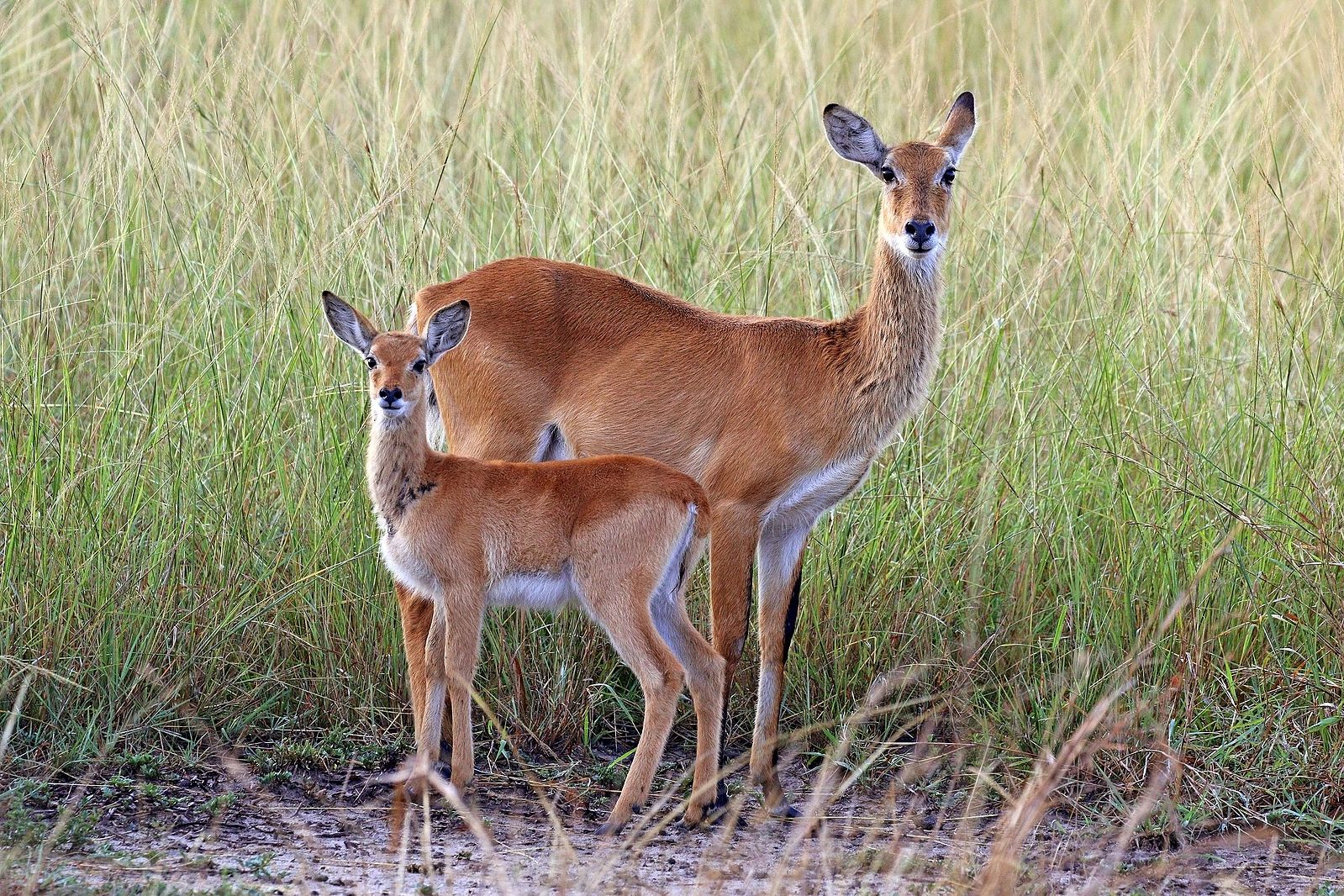
The flagship species of the Sudd Flooded Grasslands ecoregion is the white-eared kob. Image credit: Creative Commons
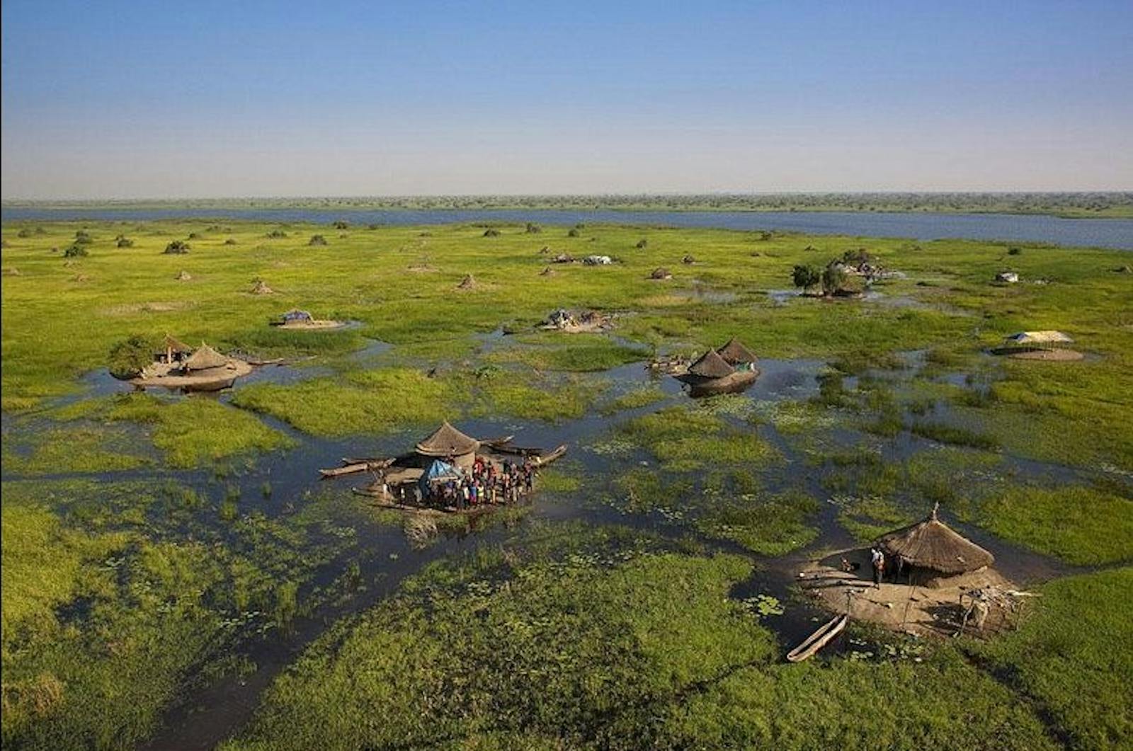
The ecoregion is located in South Sudan and comprises one of the largest swamps in Africa and is also one of the largest floodplain wetlands in the world—about 600 km long and a similar distance wide. The White Nile rises in the headwaters of Lake Victoria in a region of year-round rainfall and overflows in South Sudan into a shallow depression, creating the Sudd swamps at 380–450 m above sea level. Since 1961, inflow to the Sudd has increased substantially, presumably due to increased rainfall around Lake Victoria.
The southern portion of the floodplain is wetter than the northern, receiving on average about 800 mm per annum compared to the north’s 600 mm. These rains fall between April and September during the hot season and are controlled by the movement of the Intertropical Convergence Zone (ITCZ).
Moving from the interior of the swamps, the ecological zones grade from the open-water and submerged vegetation of a river-lake to floating fringe vegetation, to seasonally flooded grassland, to rain-fed wetlands, and finally to floodplain woodlands. Cyperus papyrus is dominant at riversides and in the wettest swamps. Phragmites and Typha swamps are extensive behind the papyrus stands, and there is an abundance of submerged macrophytes in the open waterbodies. Seasonal floodplains, up to 25 km wide, are found on both sides of the main swamps. Wild rice and Echinochloa pyramidals grasslands dominate the seasonally inundated floodplains.
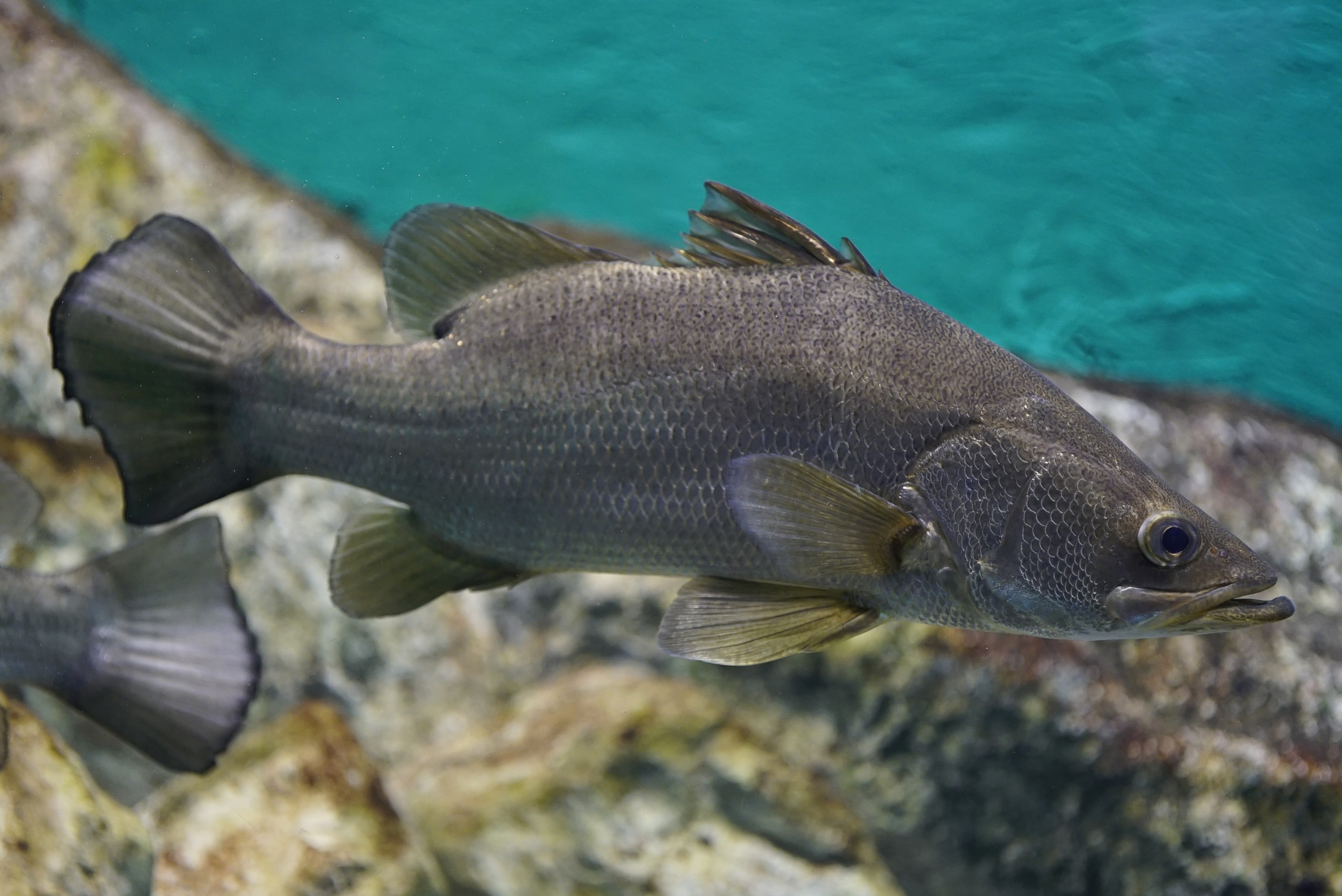
Nile perch. Image credit: Daiju Azuma, Creative Commons
The Sudd wetlands support a rich biota and major migrations of birds and mammals occur here. The endemic Nile lechwe occurs, numbering between 30,000–40,000 individuals. The most abundant antelopes are the kob, tiang, and Mongalla gazelle which undertake large-scale migrations. For example, a million individuals of white-eared kob used to make a massive migration over 1,500 km near the Ethiopian border, following the availability of floodplain grasses. Moreover, the tiang, which migrated from the Zeraf area to the South West in the 1980s, were thought to number half a million.
The current status of these migrations is unknown, but is probably considerably reduced. Surveys in 2007 indicated a population of over 758,000 white-eared kob and over 155,000 tiang in South Sudan. The floodplains provide important habitat for wetland birds, with over 2.5 million using the floodplains of the Sudd annually, mainly migratory species moving between Europe and Africa. The area is also a stronghold for the great white pelican, ferruginous duck, and black crowned crane. Werner's garter snake is a near-endemic snake, but other amphibians and reptiles are unremarkable.
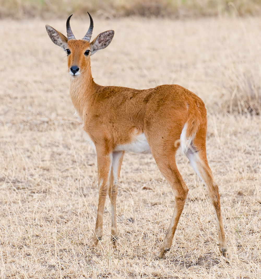
Bohor reedbuck. Image credit: Yathin S Krishnappa, Creative Commons
The Sudd swamp covers at least 30,000 km2 and the peripheral effects of the swamp are believed to extend over the entire ecoregion. Much of the area remains as a vast near-wilderness area. The designated protected areas in the ecoregion include: Sudd Ramsar site (57,000 km2), Shambe National Park (620 km2), Ez Zeraf Game Reserve (8,000 km2), and Fanyikang Game Reserve (480 km2). Boma and Badingilo National Parks protect part of the ecoregion, as well as adjacent ecosystems.
It is estimated that more than 1 million people are dependent on the Sudd and the annual floods to regenerate the floodplain grasses, for example, to feed their herds of cattle. The civil war in South Sudan poses the largest threat to the large mammals of the region, particularly tiang and kob, due to hunting by armed forces and local communities. The intensity and overall effect of the poaching will be difficult to assess until the conflict ends.
Lack of effective management and protection in the parks means that poaching is uncontrolled, and it is believed that populations of elephant and other large ungulates, have been decimated. Plans have existed since 1902 to divert the waters of the White Nile around the Sudd swamps via the Jonglei Canal. Work on the canal began in 1978 but was stopped in 1984 because of the outbreak of the second civil war.
_close_CC-George%20Berniger%20Jr.-2014.JPG)
Leopard lungfish. Image credit: George Berniger Jr., Creative Commons
There are recent plans to begin constructions and if completed, the canal may impact siltation and water quality resulting in the loss of biodiversity, fish habitats and grazing areas. Also, the empty canals block the annual movement of the tiang southwest to their wet season grazing area, and many thousands have been shot as they try to find crossing points. A growing threat is from oil extraction and its associated activities including the possible construction of pipelines to transport crude oil for export and roads through migration corridors.
Priority conservation actions for the next decade.
- Develop community conservancies in key corridor zones;
- Eliminate oil concessions within protected areas;
- Expand protected areas to account for seasonal ranges and the migration corridors.
-
-
Citations
1. Burgess, N., Hales, J.A., Underwood, E., Dinerstein, E., Olson, D., Itoua, I., Schipper, J., Ricketts, T. and Newman, K. 2004. Terrestrial ecoregions of Africa and Madagascar: a conservation assessment. Island Press.
2. Morjan, M.D., Rayl, N.D., Elkan, P.W., Deutsch, J.C., Henke, M.B. and Fuller, T.K. 2018. Armed conflict and development in South Sudan threatens some of Africa’s longest and largest ungulate migrations. Biodiversity and Conservation. 27(2), pp.365-380
3. Rebelo, L.M., Senay, G.B. and McCartney, M.P. 2012. Flood pulsing in the Sudd wetland: Analysis of seasonal variations in inundation and evaporation in South Sudan. Earth Interactions. 16(1), pp.1-19.
4. Hughes, R. H. and Hughes, J.S. 1992. A directory of African wetlands. Switzerland and Cambridge, UK: IUCN. -
Cite this page: Sudd Flooded Grasslands. Ecoregion Snapshots: Descriptive Abstracts of the Terrestrial Ecoregions of the World, 2021. Developed by One Earth and RESOLVE. https://www.oneearth.org/ecoregions/sudd-flooded-grasslands/
-

Subscribe to receive monthly updates on climate solutions, environmental heroes, and the profound beauty and wonder of our shared planet Earth.
