

Victoria Basin Forest-Savanna
The ecoregion’s land area is provided in units of 1,000 hectares. The protection goal is the Global Safety Net (GSN1) area for the given ecoregion. The protection level indicates the percentage of the GSN goal that is currently protected on a scale of 0-10.
Bioregion: Victoria Basin & Albertine Rift Forests (AT12)
Realm: Afrotropics
Ecoregion Size (1000 ha):
16,704
Ecoregion ID:
61
Conservation Target:
13%
Protection Level:
8
States: Uganda, Rwanda, Tanzania, Democratic Republic of Congo, Burundi, Kenya
Lake Victoria, formed as a result of tectonic uplift of the eastern and western rifts, is the largest freshwater lake in Africa and the second largest in the world in terms of surface area. It supports approximately 30 million people’s livelihoods including irrigated agriculture and fishing. The basin supports a mixture of forest and savanna habitats, important assemblages of savanna mammals, such as the chimpanzees which are found in many of the forested areas of the western parts of the ecoregion.
Centered on Lake Victoria, the ecoregion encompasses most of south-central Uganda, the eastern half of Rwanda and extends marginally into Tanzania, Burundi, Democratic Republic of Congo (DRC), and Kenya. The climate is tropical humid savanna with annual mean maximum temperatures ranging from 24° to 27°C and mean minimum temperatures ranging from 15° to 18°C.
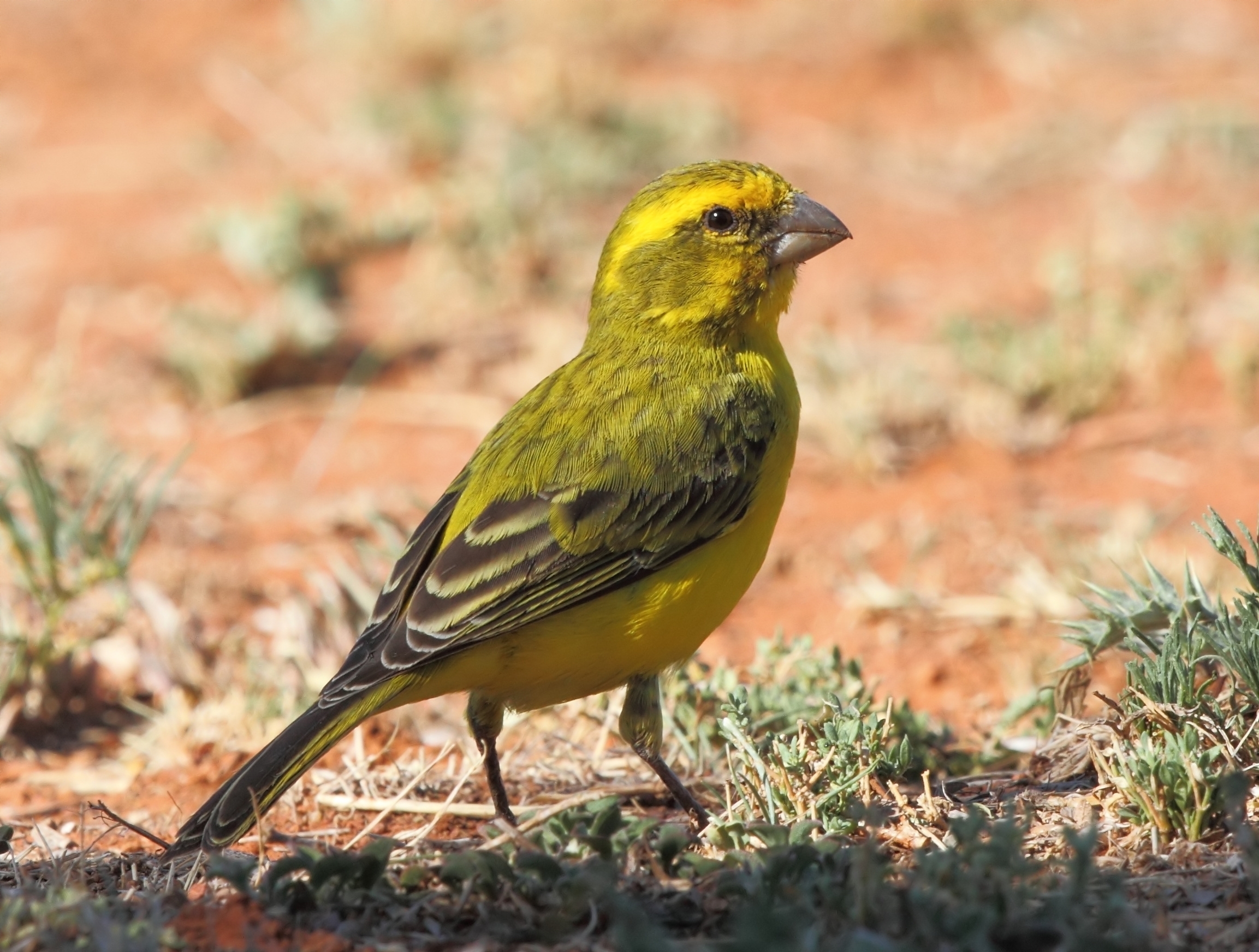
The flagship species of the Victoria Basin Forest-Savanna ecoregion is the papyrus canary. Image credit: Creative Commons
Most of the ecoregion receives between 1,000 to 1,400 mm rainfall, but this exceeds 2,000 mm on the Sesse Islands in Lake Victoria. Rain generally falls in two seasons, from March to May and August to November. Middle Pleistocene tectonic events shaped the western branch of the Great Rift Valley and uplift reversed the flow of the Kagera River, which now demarcates parts of the national boundaries of Tanzania with Rwanda and Uganda. The altered hydrology created the shallow (maximum 75 m deep) and young (about 0.75 million years old) Lake Victoria.
The unique Sango Bay to Minziro alluvial forests grow on a floodplain where the Kagera River enters Lake Victoria. These forests support both Guineo-Congolian low-land species, dominated by Baikiaea insignis, and Afromontane species. A great variety of savanna types occupy areas where rainfall is too low for forest. Papyrus (Cyperus papyrus) swamp occurs widely in the ecoregion. Outside protected areas, years of overexploitation have left only remnant patches of these savanna habitats, in a matrix of secondary habitat and farmland.
There is a diverse flora in this ecoregion, but rates of endemism are low. The Sango Bay-Minziro forest supports Afromontane elements in the flora, and some endemic plant species. Native tree species support a larger number of birds than exotic trees, often planted by farmers including pine and eucalyptus. The avifauna is species rich but supports only two strict endemic species: the papyrus canary and Fox’s weaver - both found in Papyrus swamp vegetation.
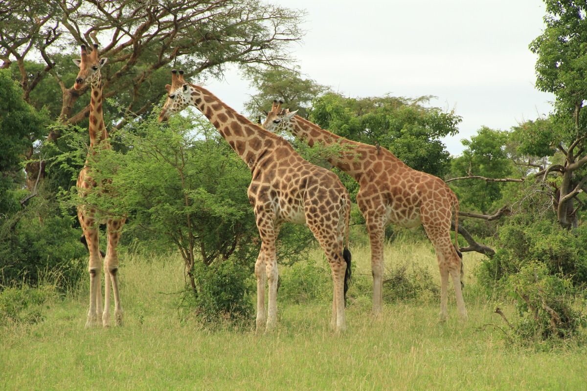
Giraffes. Image credit: Drex Rockman, Creative Commons
The large swamps in this ecoregion support a diverse assemblage of water birds, including the shoebill, a stork relative, which occurs at low densities. A high diversity of mammals occurs, but there are only three strictly endemic species: the dark shrew, moon shrew, and Issel’s groove-toothed swamp rat. Kibale forest is one of the most primate-rich forests in Africa, supporting 12 species.
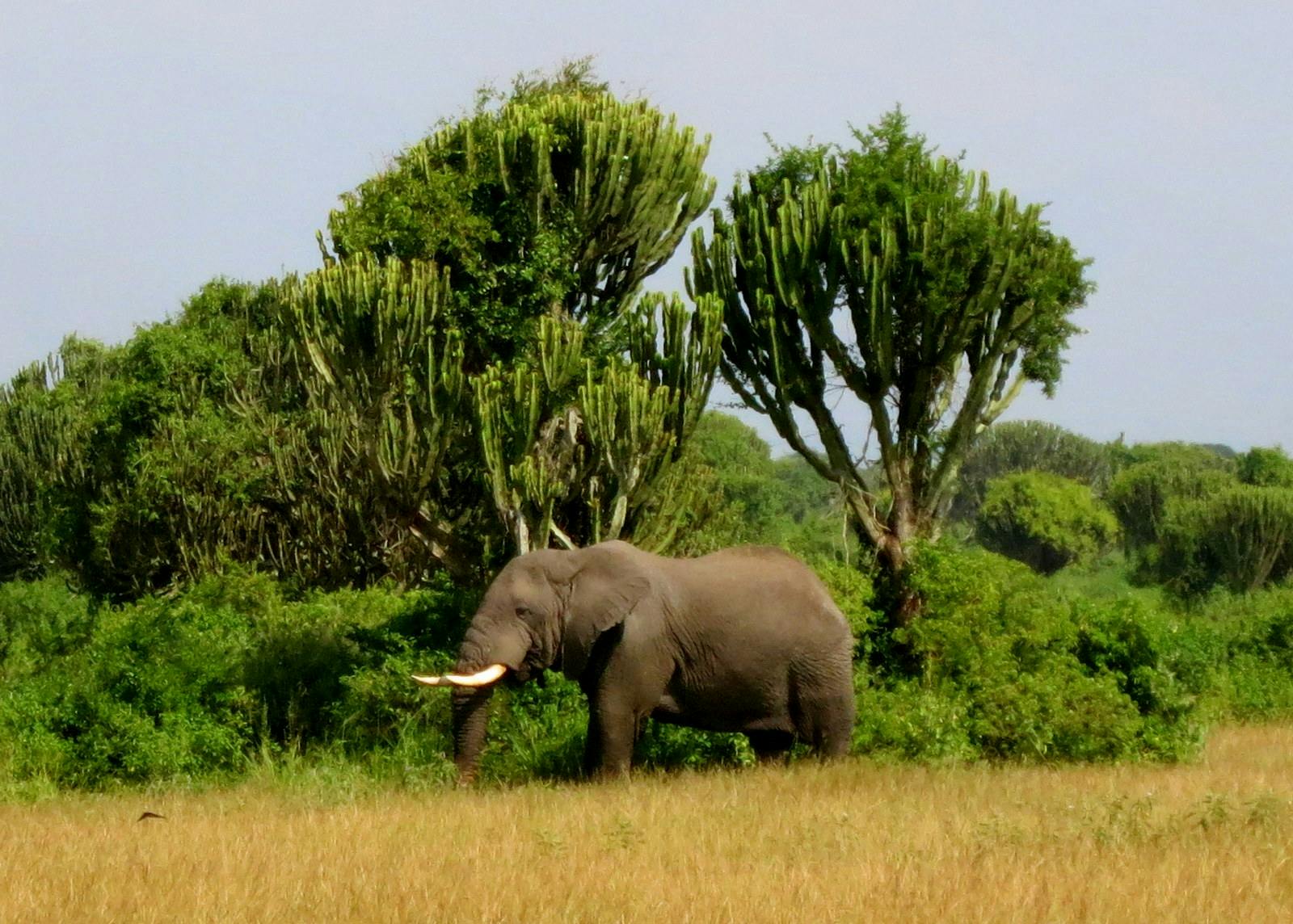
In the drier parts of the ecoregion where savanna dominates, there are significant, although diminished populations of the African elephant. The amphibians and reptiles are diverse, but again there are few endemic species.
Most of the important sites are protected as national parks, game reserves, and forest reserves. Within the Albertine Rift Valley are Queen Elizabeth National Park (QENP) and Kyambura Wildlife Reserve. The DRC’s Parc de Virunga, to the west of Lake Edward, adjoins the QENP. Outside of this concentration, protected areas are fewer and further apart. They include Lake Mburo and Murchison Falls National Parks in Uganda, Saiwa Swamp and Lugari Forest Reserve in Kenya, Forêt de Murehe in Burundi, and Akagera National Park in Rwanda.
Most of the forest in the ecoregion is found within forest reserves, originally established to control timber extraction.
In 1979, the war in Uganda literally decimated the elephant population and extirpated populations of white and black rhinoceros, however, relative internal stability through the 1990s enhanced conservation management once again, and large mammal populations began to increase. Civil war affected Burundi, Rwanda, DRC, and Sudan during the 1980s and 1990s.
Rebel armies poached bushmeat, hardwood, and elephant ivory for survival, and to sell for arms. Today, a major threat to the ecoregion is encroachment by refugees and pastoralists with cattle into protected areas. Aquatic and lakeshore habitats are also threatened by unsustainable fishing practices and the clearance of wetland areas. Agricultural intensification results in a large decrease in bird species abundance and richness.
The priority conservation actions for the next decade will be to: 1) support the implementation of sustainable natural resource use whilst maintaining traditional and indigenous values, for example using biogas to lower their dependence on fuel wood; 2) implement community-based restoration of ecological corridors, for example, to encourage and enable chimpanzee movement, and 3) utilize resource allocation in anti-poaching planning in order to achieve optimal deployment of rangers.
Citations
1. Burgess, N., Hales, J.A., Underwood, E., Dinerstein, E., Olson, D., Itoua, I., Schipper, J., Ricketts, T. and Newman, K. 2004. Terrestrial ecoregions of Africa and Madagascar: a conservation assessment. Island Press.
2. Birdlife International. 2012. Conservation Strategy for the Great Lakes Region of East and Central Africa. [Online]. [Accessed 23 February 2018]. Available from: http://www.birdlife.org/sites/default/files/attachments/AUTHORISED-GLR-STRATEGY_0.pdf
3. Critchlow, R., Plumptre, A.J., Alidria, B., Nsubuga, M., Driciru, M., Rwetsiba, A., Wanyama, F. and Beale, C.M. 2017. Improving Law‐Enforcement Effectiveness and Efficiency in Protected Areas Using Ranger‐collected Monitoring Data. Conservation Letters. 10(5), pp.572-580.
4. Bolwig, S., Pomeroy, D., Tushabe, H. and Mushabe, D. 2006. Crops, trees, and birds: Biodiversity change under agricultural intensification in Uganda's farmed landscapes. Geografisk Tidsskrift-Danish Journal of Geography. 106(2), pp.115-130.

Subscribe to receive monthly updates on climate solutions, environmental heroes, and the profound beauty and wonder of our shared planet Earth.
