

Zambezian Flooded Grasslands
The ecoregion’s land area is provided in units of 1,000 hectares. The conservation target is the Global Safety Net (GSN1) area for the given ecoregion. The protection level indicates the percentage of the GSN goal that is currently protected on a scale of 0-10. N/A means data is not available at this time.
Bioregion: Greater African Subequatorial Savannas & Mixed Woodlands (AT11)
Realm: Afrotropics
Ecoregion Size (1000 ha):
20,315
Ecoregion ID:
76
Conservation Target:
53%
Protection Level:
9
States: Angola, Botswana, Democratic Republic of Congo, Malawi, Mozambique, Tanzania, Zambia
The Zambezian Flooded Grasslands support an impressive mammal fauna, including huge herds of large mammals that undertake seasonal migrations. The Liuwa plains are home to approximately 30,000 migratory blue wildebeest, the largest herd in Zambia. The populations of lechwe, a highly aquatic antelope species, are known to exceed 20,000 in Moremi Game Reserve, while more than 35,000 of the endemic subspecies, the Kafue lechwe have been recorded in Lochinvar National Park.
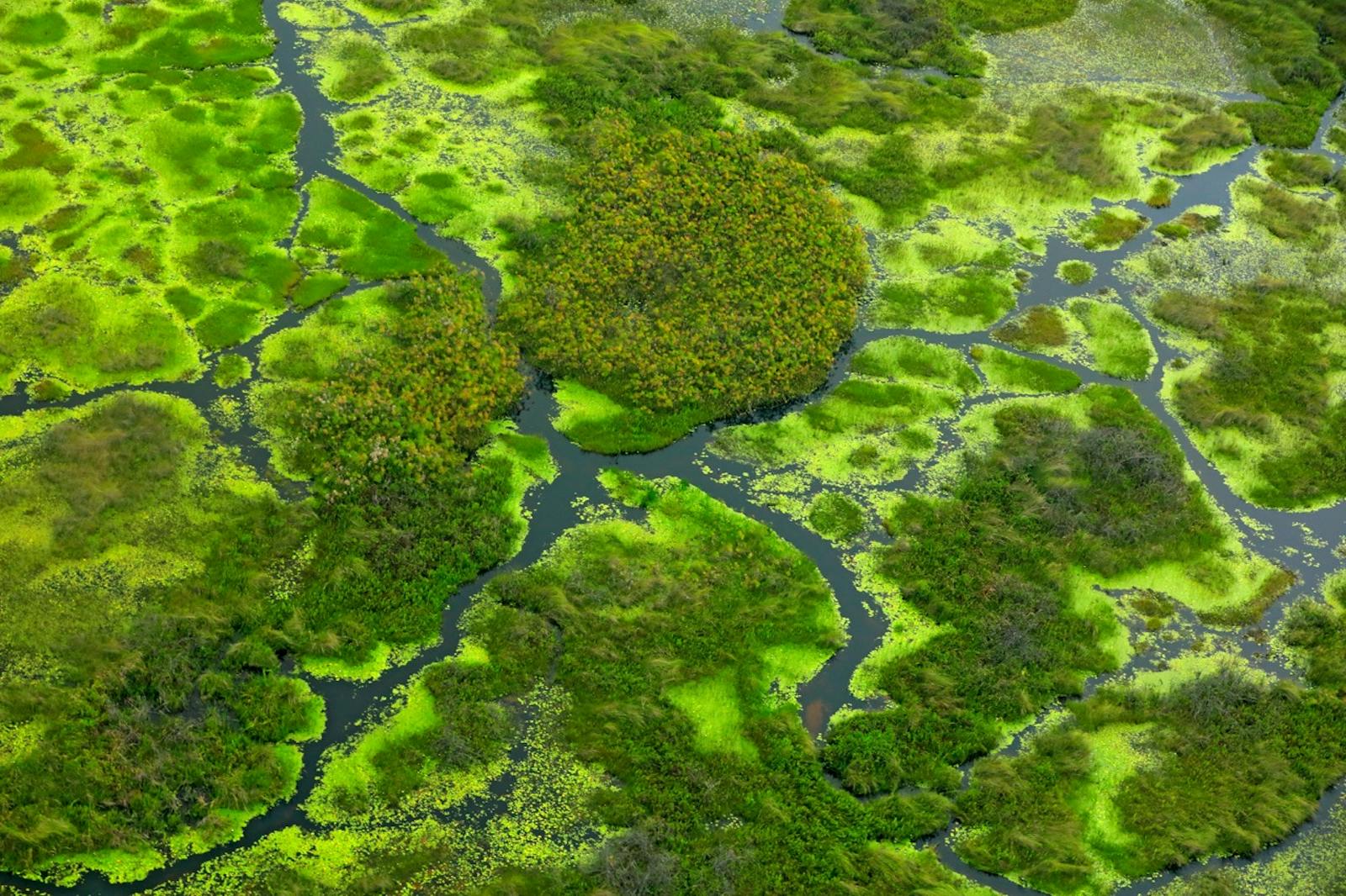
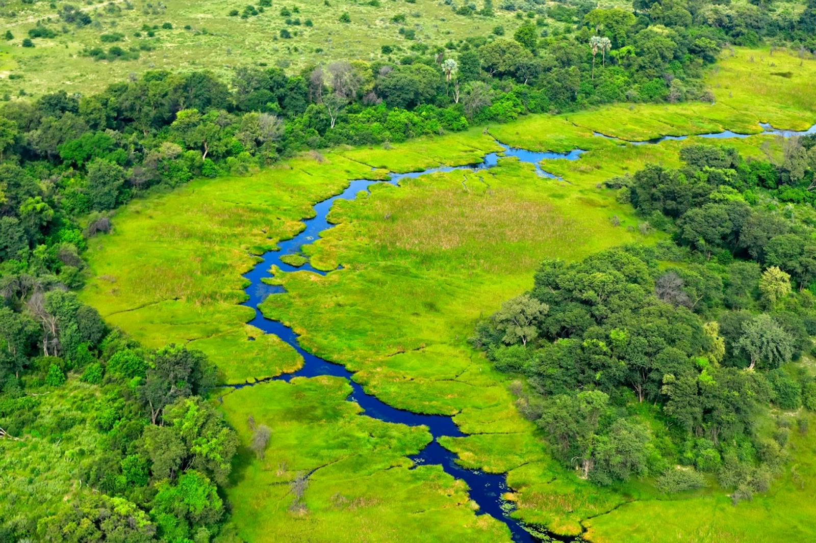
Embedded predominantly within miombo and mopane woodlands, the ecoregion occurs as isolated patches from northern Botswana in the south, to Tanzania in the north. It includes grasslands in the Kilombero Valley, Moyowosi/Malagarasi system and the Ugalla River in Tanzania; the Okavango Delta in Botswana; Lake Chilwa in Malawi; the Barotse Floodplain, the Kafue Flats and the Bangwuelu/Luapala/Chambezi system in Zambia, as well as the Liuwa, Silowana and Mulonga grassland plains.
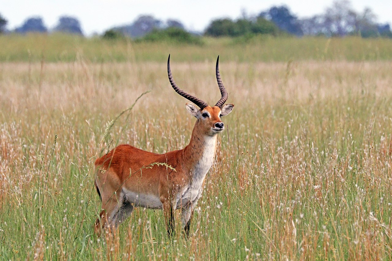
The flagship species of the Zambezian Flooded Grasslands ecoregion is the lechwe. Image credit: Charles J Sharp, Creative Commons
The climate is seasonal and tropical, with rainfall occurring during the hot summer months, which is mostly between November and March in the south, and goes on through to the end of May in the north. Droughts lasting up to seven months typify the cooler season. The variation in rainfall across the ecoregion is fairly high, with Lake Bangweulu experiencing annual rainfall in excess of 1,400 mm, while the Okavango of Botswana in Tanzania can receive as little as 450 to 600 mm. Inundation of these wetlands is contingent not only on localized rainfall, but on rivers from wetter catchments.
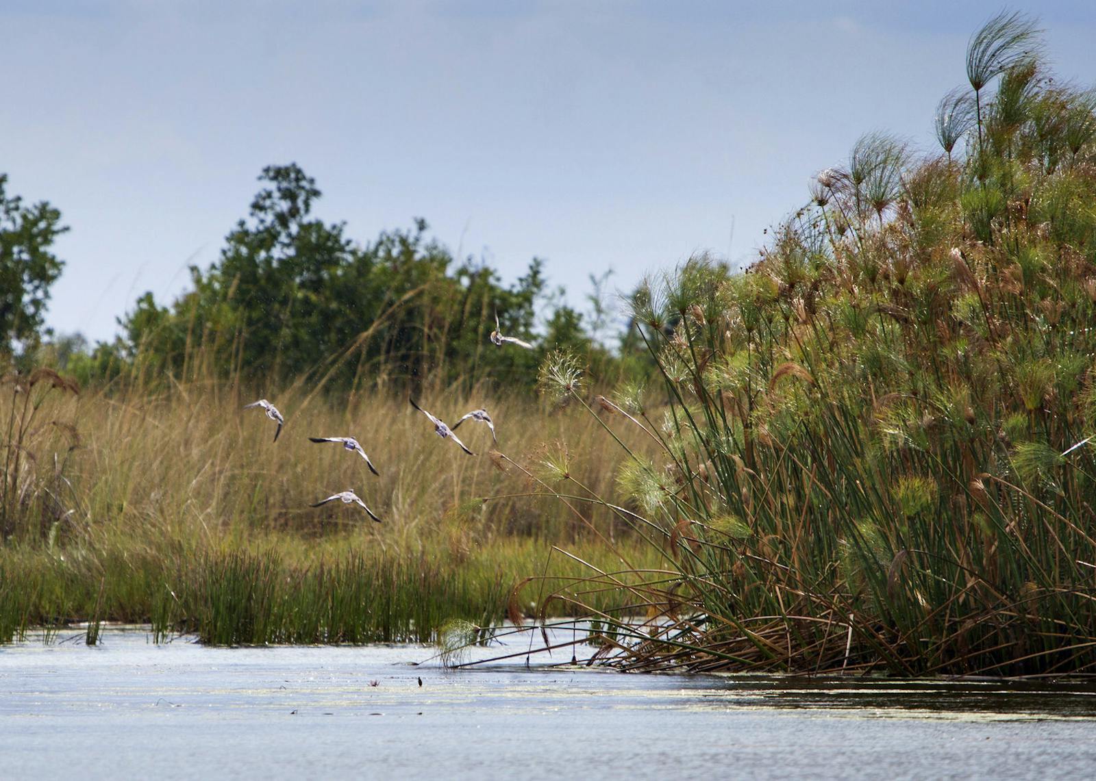
The vegetation is characterized mostly by a mosaic of edaphic grassland and semi-aquatic vegetation, and local variation in flora between wetlands is fairly high because of the wide distribution of the flooded areas that constitute this ecoregion. Grasses belonging to the genera Acrocera, Echinochloar, Leersia, Oryza, Phragmites, Typha, and Vossia, together with Cyperus papyus, dominate most of these wetlands. Some wetlands, such as Lake Chilwa, support halophytic vegetation.
-CC-Paul%20Maritz-2002.jpg)
Tsessebe. Image credit: Paul Maritz, Creative Commons
There are few endemic species in this ecoregion, but the overall species richness is high, especially for birds. The only strict endemic bird is the Kilombero weaver. Near-endemic birds include the Tanzania masked weaver and the Katanga masked weaver. Other globally threatened species are wattled crane and corncrake. More than 20,000 Cape buffalo occur in the Moyowosi delta of northwestern Tanzania.
There are also significant populations of waterbuck, burchell’s zebra, sable antelope, southern reedbuck, tsessebe, wildebeest, oribi, and sitatunga. Hippopotamus is also common. Large carnivores include lion, African wild dog, and cheetah.
Amphibian and reptile species richness and endemicity are not particularly high, with only two strict endemic species. The merera toad is known only from the Kilombero Floodplain, while the Barotse water snake only occurs on the Kalabo Floodplain. The Nile crocodile is also common.
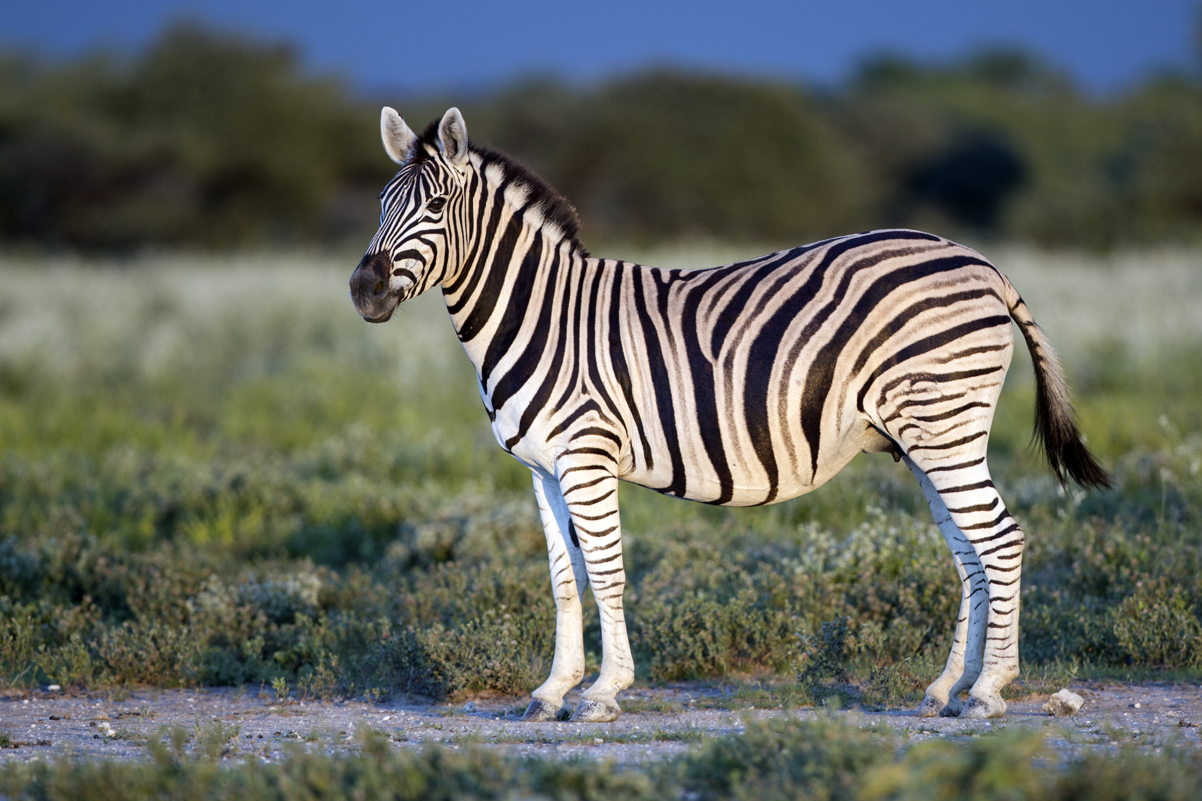
Burchell’s zebra. Image credit: Yathin S Krishnappa, Creative Commons
The largest wetland in this ecoregion is the Okavango Delta (68,640 km2), which is mainly protected within the Moremi Game Reserve and two adjacent wildlife management areas. It has been designated a Ramsar site for supporting a rich diversity of birds, with more than 650 species recorded. Zambia contains several protected areas; Lochinvar and Blue Lagoon National Parks and the Bangweulu Game Management Areas are considered key locations for threatened antelopes in sub-Saharan Africa. Bangweulu is also designated as a Ramsar site, with more than 400 bird species.
Additionally, the Liuwa plain National Park and the surrounding Western Zambezi game management area protected large grassland plains. Three important wetlands in Tanzania are protected within Ramsar sites and state level protected areas: Kilombero Valley Floodplain Ramsar site (7,967 km2), Malagarasi-Muyovozi Ramsar site (32,500 km2), and the Ugalla Game Reserve and Forest Reserves.
%2C%20Okavango%20Delta-CC-Diego%20Delso-2018.jpg)
Saddle billed stork. Image credit: Diego Delso, Creative Commons
While several of the wetlands such as the Barotse Floodplain and the Kafue Flats have been occupied for centuries, more recent large-scale changes are becoming evident in many of the areas as human activities and land-use intensifies, including converting pastoral areas to farmland. Kilombero valley is one of Tanzania’s most fertile areas and as a result it is heavily used for cattle grazing and conversion to agriculture. In addition, illegal fishing, particularly in Ugalla game reserve, and overfishing are becoming issues of increasing concern.
Water diversion for irrigation and hydroelectric dams have already affected some floodplain systems. Dams affect the natural movement of water downstream, for example, the Itezhi Tezhi Dam on the Kafue River has changed the flood regime such that unseasonal flooding occurs on the flats, threatening the breeding sites of the wattled crane and grey crowned crane. Hunting pressure is intense and uncontrolled burning create problems for nesting birds.
The priority conservation actions for the next decade will be to: 1) strengthen the monitoring networks for water quality and hydrology of surface waters and biodiversity; 2) establish game corridors and transboundary management of wetlands and upstream ecosystems, for example the Kavango Zambezi transfrontier conservation area; and 3) restore natural flood regimes through changes to current and planned dam operations.
Citations
1. Burgess, N., Hales, J.A., Underwood, E., Dinerstein, E., Olson, D., Itoua, I., Schipper, J., Ricketts, T. and Newman, K. 2004. Terrestrial ecoregions of Africa and Madagascar: a conservation assessment. Island Press.
2. The Permanent Okavango Rover Basin Water Commission. 2011. Cubango-Okavango River Basin Transboundary Diagnostic Analysis. Maun, Botswana: OKACOM, 2011.
3. European Commission. 2016. Larger than elephants: Inputs for an EU strategic approach to wildlife conservation in Africa Regional Analysis. Luxembourg: Publications office of the European Union.
4. Kalumba, M. and Nyirenda, E. 2017. River flow availability for environmental flow allocation downstream of hydropower facilities in the Kafue Basin of Zambia. Physics and Chemistry of the Earth, Parts A/B/C. 102, pp.21-30.

Subscribe to receive monthly updates on climate solutions, environmental heroes, and the profound beauty and wonder of our shared planet Earth.
