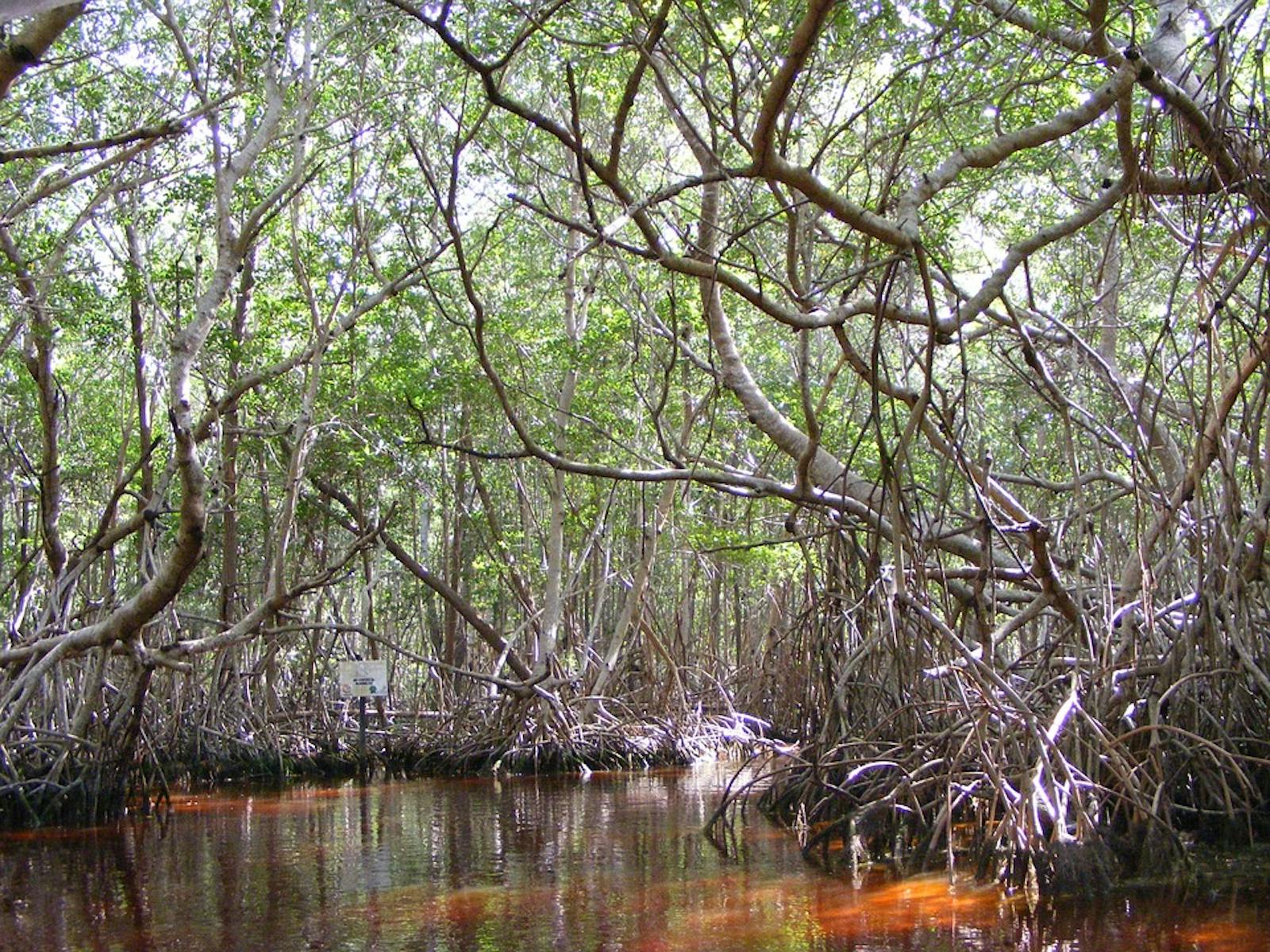

Mesoamerican Gulf-Caribbean Mangroves
The ecoregion’s land area is provided in units of 1,000 hectares. The protection goal is the Global Safety Net (GSN1) area for the given ecoregion. The protection level indicates the percentage of the GSN goal that is currently protected on a scale of 0-10.
Bioregion: Central American Mixed Forests (NT25), Yucatan & Veracruz Mixed Forests (NT27), Central American Isthmian & Colombian Coastal Forests (NT24)
Realm: Southern America
Ecoregion Size (1000 ha):
2,680
Ecoregion ID:
613
Conservation Target:
71%
Protection Level:
8
States: Mexico, Nicaragua, Belize, Honduras, Panama, Guatemala, Costa Rica
The critically endangered hawksbill sea turtles, named after their sharp pointy beak resembling that of a hawk, are important residents of this mangrove community. Hawksbills help maintain the health of mangroves and the corals that grow therein. As they remove prey such as sponges from the mangroves surface, they provide better access for reef fish to feed, like ecosystem engineers. They feed and take refuge from sharks and other predators in coral reefs and mangrove swamps, browse the local sea grass beds, and nest on nearby beaches.
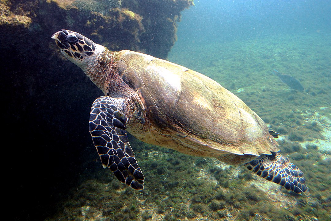
The flagship species of the Mesoamerican Gulf-Caribbean Mangroves ecoregion is the hawksbill sea turtle. Image credit: I, Thierry Caro, Creative Commons
These highly migratory species feed primarily on sponges, which are extremely abundant among the stilt roots of red and other mangrove species. Female hawksbills, like other sea turtles, travel across the oceans to the exact beach where they were hatched to lay the next generation of eggs. However, over 20 years will pass before the females reach their reproductive age, and in many cases the beaches will have already been changed dramatically and often become inaccessible to the sea turtles.
The Mesoamerican Gulf-Caribbean Mangroves ecoregion holds eleven subecoregions:
- Alvarado mangroves in the Gulf of Mexico coastal plains, in the states of Veracruz and Tamaulipas up to the Mexico/USA border;
- Usumacinta mangroves in the state of Tabasco, Mexico;
- Petenes mangroves at the border between the Mexican states of Yucatán and Campeche; the area is continuously flooded by springs beneath the mangroves;
- Rio Lagartos mangroves along the coast on the northeast end of the Yucatan Peninsula, extending south towards Cancun;
- Mayan Corridor mangroves on a plateau by the Atlantic coast in Quintana Roo, Mexico;
- Belizean Coast mangroves along the Caribbean Coast from Guatemala to the coast of Belize stopping at the Mexico border;
- Belizean Reef mangroves on islands and cayes off the coast of Belize associated with a 220 km barrier reef;
- Northern Honduras mangroves along the Caribbean coastline, east of Bahía de Amatique, Guatemala and extend west into Honduras ending near the delta of the Patuca River;
- Mosquitia-Nicaraguan Caribbean Coast mangrove along the coastline between the delta of the Patuca River in Honduras and Nicaragua just south of the Bahía Punta Gorda;
- Rio Negro/Rio San Sun mangroves along the Caribbean coastline, between the border of Nicaragua and the borders of Costa Rica and Panama; and
- Bocas del Toro/ San Bastimentos/San Blas mangroves on the Caribbean Sea coasts of Panama and southernmost Costa Rica. The characteristic vegetation of the ecoregion includes red, black, white, and button mangrove. The ecoregion is influences heavily by periodic hurricanes and other extreme weather events.
The mangrove fragments remaining across this ecoregion are important refuges for many breeding and migratory species, and offer safe-harbour to species during storms and while migrating. The Alvarado mangroves contain the Humedales de Alvarado Important Bird Area as a key migratory stop. The Usumacinta mangroves contain 374 plant, 60 fish, 26 amphibian, 85 reptile, 279 bird, and 134 mammal species.
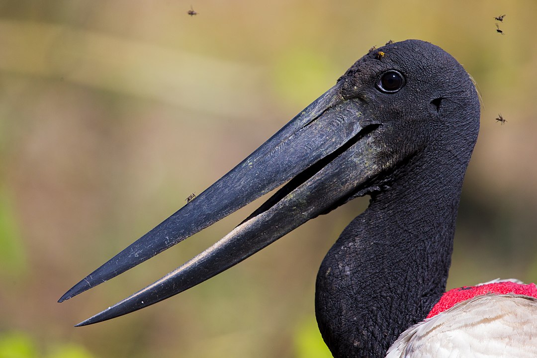
Jabiru up close. Image credit: Andreas Trepte, Creative Commons
The Petenes mangroves have 304 bird, 33 mammal, 107 fish, and 5 reptile species, including the limited ranged Mexican sheartail and Yucatan wren. Over 300,000 aquatic birds use Ría Lagartos mangroves as migrating points or wintering grounds. Characteristic birds of the Mayan Corridor mangroves include Jabiru, wood stork, white ibis, and great white heron.
Mosquitia/Nicaraguan Caribbean Coast mangrove area of the Atlantic coast is part of a biological corridor linking North and South America. In Bocas del Toro/San Bastimentos/San Blas mangroves, 36 of the 133 bird species found are endangered, as well as 24 of the 55 mammal species and 7 reptile species.
This ecoregions has been severely disturbed by humans, who clear mangroves as a resource, to improve access to the ocean and to build “water front” infrastructure.
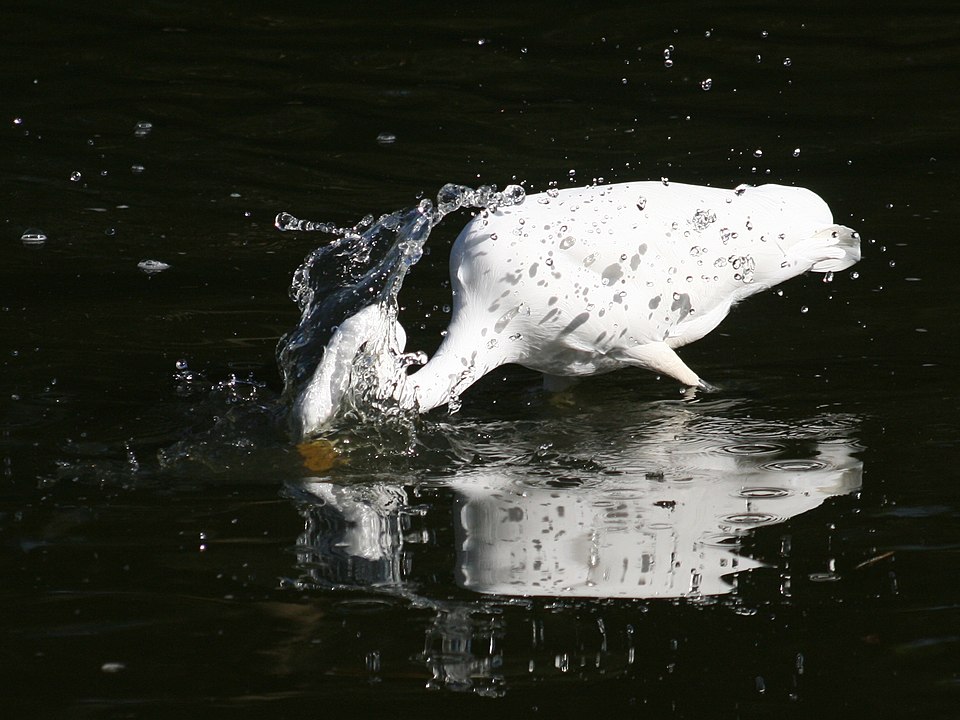
Great white heron spearing a fish. Image credit: Tony Wills, Creative Commons
The Usumacinta Mangroves form part of the Biosphere Reserve of Pantanos de Centla. In the Petenes Mangroves, water pollution has caused deterioration. The Biosphere Reserve of Ría Celestún protects territory occupied by the Petenes wetlands. Rio Lagartos is an established Protected Natural Area. The Mayan Corridor Mangroves are the only intact habitat in Quintana Roo. The Biosphere Reserve of Sian Ka’an protects coastal formations, forest, and some mangroves. The Burdon Canal Nature Reserve in Belize City protects some mangroves. Much of the Belizean Reef is protected with some overlap into mangrove areas but is not actively monitored, allowing degradation.
Four protected areas fall in the Northern Honduras Mangrove boundaries. The protected areas of Rio Negro/Rio San Sun mangroves include the Indio Maíz Biological Reserve in Nicaragua, Tortuguero National Park, and the Humedal Caribe Noreste in Costa Rica.
Major threats to the Mesoamerican Gulf-Caribbean Mangroves ecoregion include oil drilling, water pollution, timber, mining, agriculture, and dam construction. Additional threats include exploitation of local fisheries/ wildlife, human settlements, and roads for tourism.
The priority conservation actions for the next decade will be to: 1) restrict development near key mangrove areas; 2) curb pollutants by reducing reliance on chemicals and confining agriculture runoff to holding ponds; and 3) educate locals on mangrove biodiversity benefits to the community.
Citations
1. Valero, A. 2018. Veracruz, Mexico, along the Gulf of Mexico coastal plains https://www.worldwildlife.org/ecoregions/nt1401 Accessed August 8, 2018
2. Valero, A. 2018. Southern North America: Southeastern Mexico https://www.worldwildlife.org/ecoregions/nt1437 Accessed August 8, 2018
3. Valero, A. Burdette, C. Schipper, J. 2018. Southern North America: Yucatàn Peninsula in southern Mexico https://www.worldwildlife.org/ecoregions/nt1428 Accessed August 8, 2018
4. Valero, A. 2018. Southern North America: Eastern Mexico https://www.worldwildlife.org/ecoregions/nt1430 Accessed August 8, 2018

Subscribe to receive monthly updates on climate solutions, environmental heroes, and the profound beauty and wonder of our shared planet Earth.
