From research to restoration: Nine ways people are using the One Earth Navigator

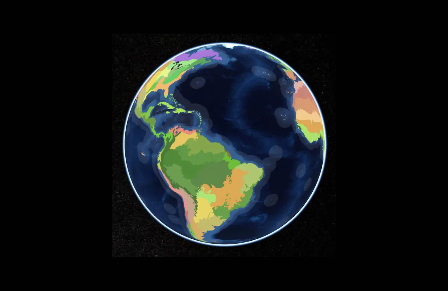
Imagine a map of the world shaped not by political borders, but by forests, grasslands, deserts, mountains, and the species that live there.
The One Earth Navigator offers a different way to explore the planet, organizing Earth into realms, subrealms, bioregions, and ecoregions shaped by shared climate, geography, plants, wildlife, and ecological history.
Behind the interactive Navigator is the One Earth Bioregions Framework. Some people use the Navigator directly to explore places, species, projects, and stories, while others download the framework and bring those ecological boundaries into research, conservation planning, maps, education, and new tools.
Since launching the Navigator, we have heard from students, teachers, researchers, conservationists, designers, developers, and curious explorers around the world about how they are putting these resources to use.
Some are studying species distributions or planning restoration projects. Others are introducing students to biogeography, building new digital tools, or simply trying to understand the ecology of the place they call home.
Here are nine ways people are exploring, studying, and connecting with our planet through the One Earth Navigator and its bioregional framework.
1. Bringing bioregions into the classroom
For students, concepts like biomes, ecosystems, and biogeographic boundaries can feel abstract until they can see them on a map. Teachers are using the Navigator to turn those concepts into places students can explore themselves.
Educator Francine K. has students research the bioregions of Chile, including endemic species, abiotic and biotic factors, and human impacts. She described the Navigator as a “critical resource for students.”
Middle school science teacher Ginger M. uses it during ecosystem research projects so students can investigate biomes, organisms, and real-world locations rather than learning about ecosystems only through text.
“What I like most about Navigator is how interactive and engaging it is for students. It allows them to actively explore biomes and ecosystems rather than just read about them.” —Ginger M.
Other educators are using the Navigator with primary school students, high school geography classes, university students, and place-based learning programs around the world.
The result is a different way of learning geography, one that invites students to investigate what makes places unique, how ecosystems connect, and what lives within them.
2. Advancing research through ecological boundaries
Researchers are also using One Earth’s bioregional framework to organize and analyze environmental data, applying the underlying bioregion data to questions ranging from global biomass and forest growth to zoonotic pathogens, species distributions, and ecological communities.
One study is using the data to analyze rodent sampling for zoonotic pathogens, while others are applying it to global biomass mapping and species distribution models.
Others are matching forest sites with bioregions to investigate how climate change affects forest growth, studying wildfires in Central Asia, or incorporating the framework into research on conservation and the sustainable management of social-ecological systems.
Bioregions give researchers another spatial lens through which to ask questions. Rather than organizing data only by countries, states, or other political units, scientists can examine patterns within regions connected by shared ecological characteristics.
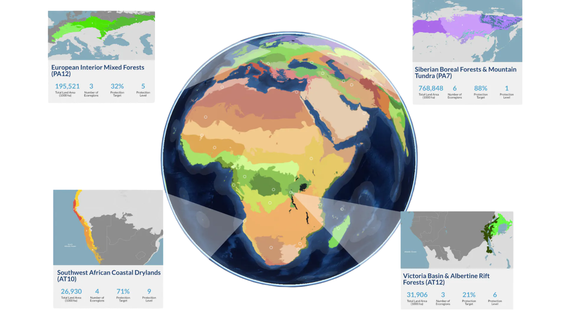
The Navigator reveals the ecological boundaries of bioregions across the planet.
3. Planning conservation and restoration efforts
Those ecological boundaries can also help people decide where and how to act.
One plant conservation team is using a bioregional approach to support cross-country collaboration around the conservation of near-endemic species and threatened habitats.
In North Carolina, Greg Lawrence is applying the framework to land he stewards. While using a permaculture approach to better understand the site, he turned to One Earth’s bioregions to learn more about the Appalachian-Blue Ridge forests.
“I hope to use the bioregions framework to increase my understanding of the flora and fauna relationships in my ecoregion to help with native species rehabilitation.” —Greg Lawrence
Other users have requested the data to identify areas important for wildlife conservation, visualize opportunities for regeneration, frame rainforest protection and restoration around bioregions, and quantify the climate benefits of afforestation and reforestation.
Understanding where an ecosystem begins and ends can be more than an academic exercise. It can help reveal which habitats, species, and ecological relationships need to be considered together.
4. Building new tools, maps, and creative projects
For some users, One Earth’s bioregional framework becomes the starting point for something entirely new.
Developers, journalists, designers, and students are incorporating bioregional data into apps, mapping tools, educational projects, games, data visualizations, and even fictional worlds.
One researcher is developing “environmental signatures” for places to investigate relationships between the natural environment and human culture.
An architecture team is using ecoregions to map where building materials come from, relating material sourcing to local ecoregions for an educational exhibition.
InfoAmazonia, meanwhile, has explored using the framework for ecological analysis, map production, public-interest journalism, data visualizations, and training materials for journalists.
People have also used Navigator data to build open-source bioregional tools, create fictional worlds, and even construct a miniature Earth in Minecraft. Together, these projects show how ecological geography can become a foundation for creativity as well as science.
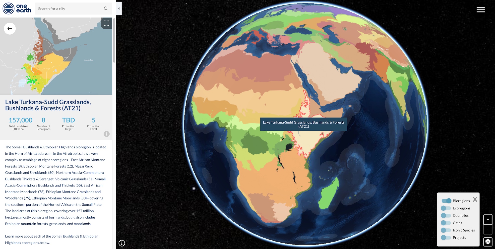
A closer look at Bioregion AT21 in the Afrotropics realm.
5. Finding the species that help ecosystems thrive
A place is more than its boundaries. It is also the relationships between the living things found there. Some Navigator users come specifically to understand the species that inhabit different regions and the ecological relationships between them.
Marlon Padilla in Colombia uses the Navigator to explore biogeographic regions and the distribution of species and wildlife. He particularly values the information connected to conservation status and wildlife within each area.
One student used the Navigator for a biome research project that involved choosing an ecoregion and constructing a large food web showing how energy moves through the ecosystem.
Across the Navigator, One Earth’s Iconic Species offer another entry point into these ecological relationships. These species help reveal how animals, plants, fungi, and other organisms interact with their habitats and the roles they play in keeping ecosystems healthy.
From pollinators and predators to ecosystem engineers and seed dispersers, following a species can be another way of understanding how a bioregion works.
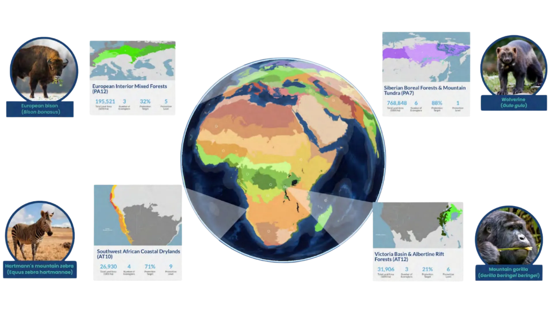
Iconic Species featured across bioregions in the One Earth Navigator.
6. Connecting nature, culture, and place
Ecological geography can also provide another lens for understanding human history and culture.
Eduardo O. uses the Navigator to explore how bioregions overlap with cultural landscapes. He says that examining places such as the Swahili Coast through ecological boundaries can offer clues about “how a certain culture came to be.”
That connection between ecology and culture is showing up in other projects too. Researchers have explored using bioregions to understand relationships between environmental conditions and human settlements.
One municipal parks team has explored incorporating bioregions into educational materials at a local arboretum, with programming designed to connect tree species with cultures and ecologies around the world through events, art installations, tree walks, and other educational experiences.
Mountains, rivers, coastlines, climate, soils, plants, and wildlife have always influenced where and how people live. Viewing human places within their ecological context can reveal some of those relationships.
7. Seeing climate solutions in action
Understanding a place is one step. The next question is often what people can do to protect it, restore it, or build a more resilient future there. The Navigator allows users to move from exploring ecological systems to discovering solutions already being put into practice.
Across the globe, projects featured by One Earth are advancing solutions across our three pillars of climate action: Energy Transition, Nature Conservation, and Regenerative Agriculture.
That might mean restoring forests, protecting critical habitats, changing how food is grown, expanding renewable energy, rebuilding coastal ecosystems, or strengthening community-led conservation.
Rather than presenting climate action as a single global challenge, the Navigator helps people discover solutions tailored to specific places and communities.
It offers a way to ask not only, What kind of place is this? but also, What are people doing here?
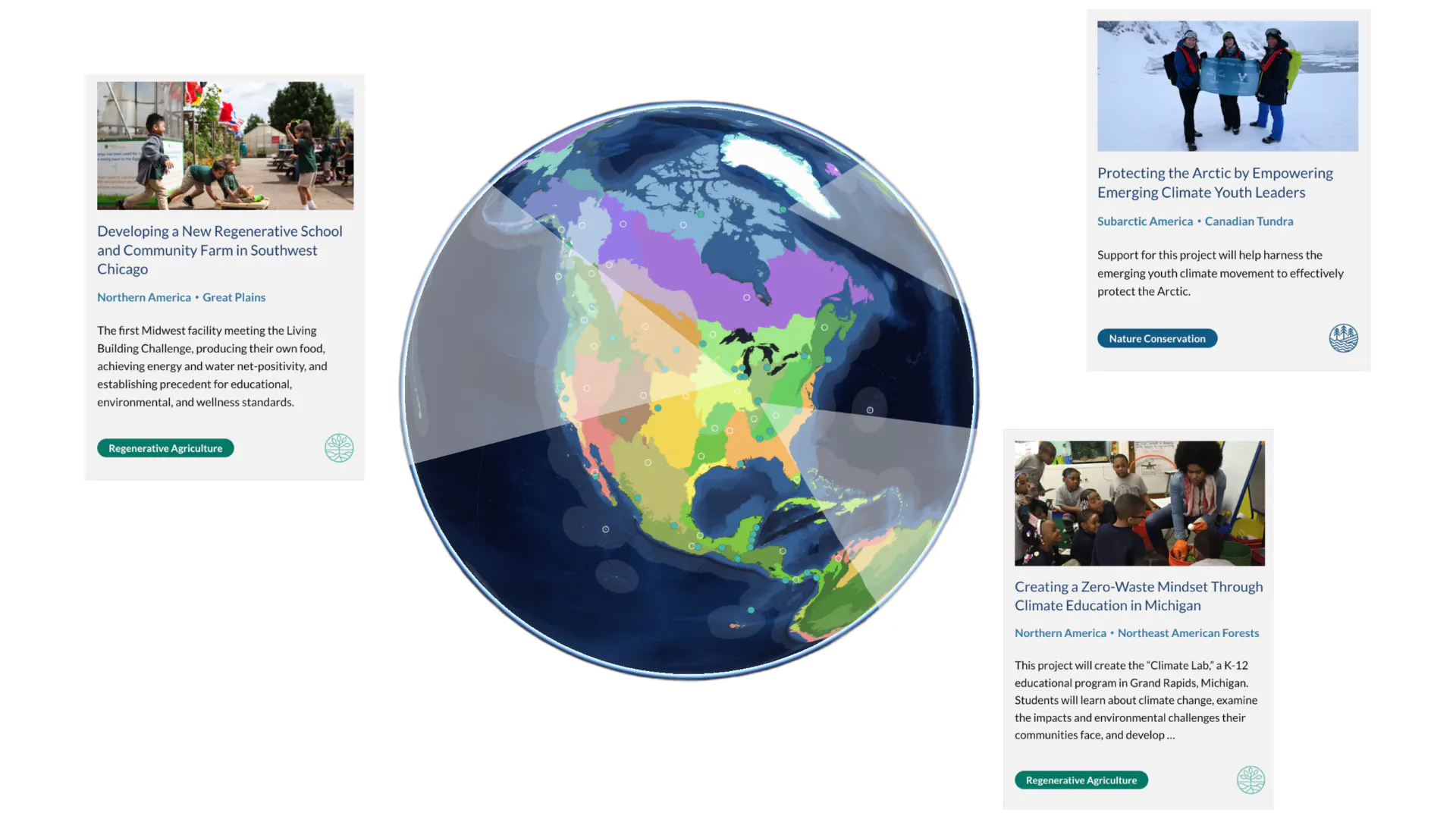
Climate solutions come into view through projects mapped across the One Earth Navigator.
8. Discovering the people and stories behind solutions
Maps can tell us where change is happening, but they cannot tell the whole story.
One of the latest updates to the Navigator brings more of One Earth’s storytelling directly into the experience, connecting places around the world with the people and solutions shaping their future.
Readers can encounter One Earth Heroes working to protect and restore the places they call home, alongside stories showing climate solutions and conservation efforts in action.
That means exploring a region can lead somewhere unexpected. A forest can lead to the community restoring it. A coastline can lead to the people protecting its mangroves. A landscape shaped by agriculture can lead to farmers changing how food is grown.
These stories bring the people behind climate action into focus and show how a thriving future is already taking shape, place by place.
9. Finding your own place on the planet
For all the ways people use the Navigator to explore distant bioregions, one of its most personal uses begins much closer to home.
Elizabeth in Montreal, Canada came to the Navigator looking for an ecologically meaningful way to define the region where she lives, something she could use “as a place to ground my activism.”
Phillip B. uses it for a similarly personal reason: “to better understand my specific bioregion and how to help.”
María Molina discovered the Navigator while researching the Venezuela Llanos & Dry Forests bioregion and Cordillera de Mérida Páramo ecoregion, which includes her own city.
“Finding the Navigator feels like an open door to knowing new places from a different, intuitive, and deep perspective.” —María Molina
Finding your bioregion can reveal the larger living system your home belongs to, from the climate and ecosystems that shape it to the species, watersheds, and landscapes you share with neighboring communities.
That may be one of the most powerful things a map can do: change how we see the place we call home and our relationship with the natural world around us.
Ready to discover your place on the planet? Explore the One Earth Navigator and find your bioregion, its iconic species, and the people working to protect and restore it.

Subscribe to receive monthly updates on climate solutions, environmental heroes, and the profound beauty and wonder of our shared planet Earth.