Strengthening Indigenous-led Mapping and Real-time Monitoring in the Upper Amazon
- Nature Conservation
- Wildlife Connectivity
- Forests
- Women
- Indigenous Tenure
- Science & Technology
- Biodiversity
- Daughters for Earth
- Amazonia
- Southern America Realm
| Bioregion | Northern Amazonian Forests (NT20) |
| Category | Nature Conservation Our project categories represent one of three core solutions pathways to solving climate change. Energy Transition focuses on renewable energy access and energy efficiency. Nature Conservation includes wildlife habitat protection and ecosystem restoration, as well as Indigenous land rights. Regenerative Agriculture supports farmers, ranchers, and community agriculture. |
| Realm | Southern America Projects are organized by the major terrestrial realms divided into 14 biogeographical regions – N. America, Subarctic America, C. America, S. America, Afrotropics, Indomalaya, Australasia, Oceania, Antarctica, and the Palearctic realm, which coincides with Eurasia and is divided into Subarctic, Western, Central, Eastern, and Southern regions. |
| Partner | Amazon Frontlines |
One Earth’s Project Marketplace funds on-the-ground climate solutions that are key to solving the climate crisis through three pillars of collective action — renewable energy, nature conservation, and regenerative agriculture.
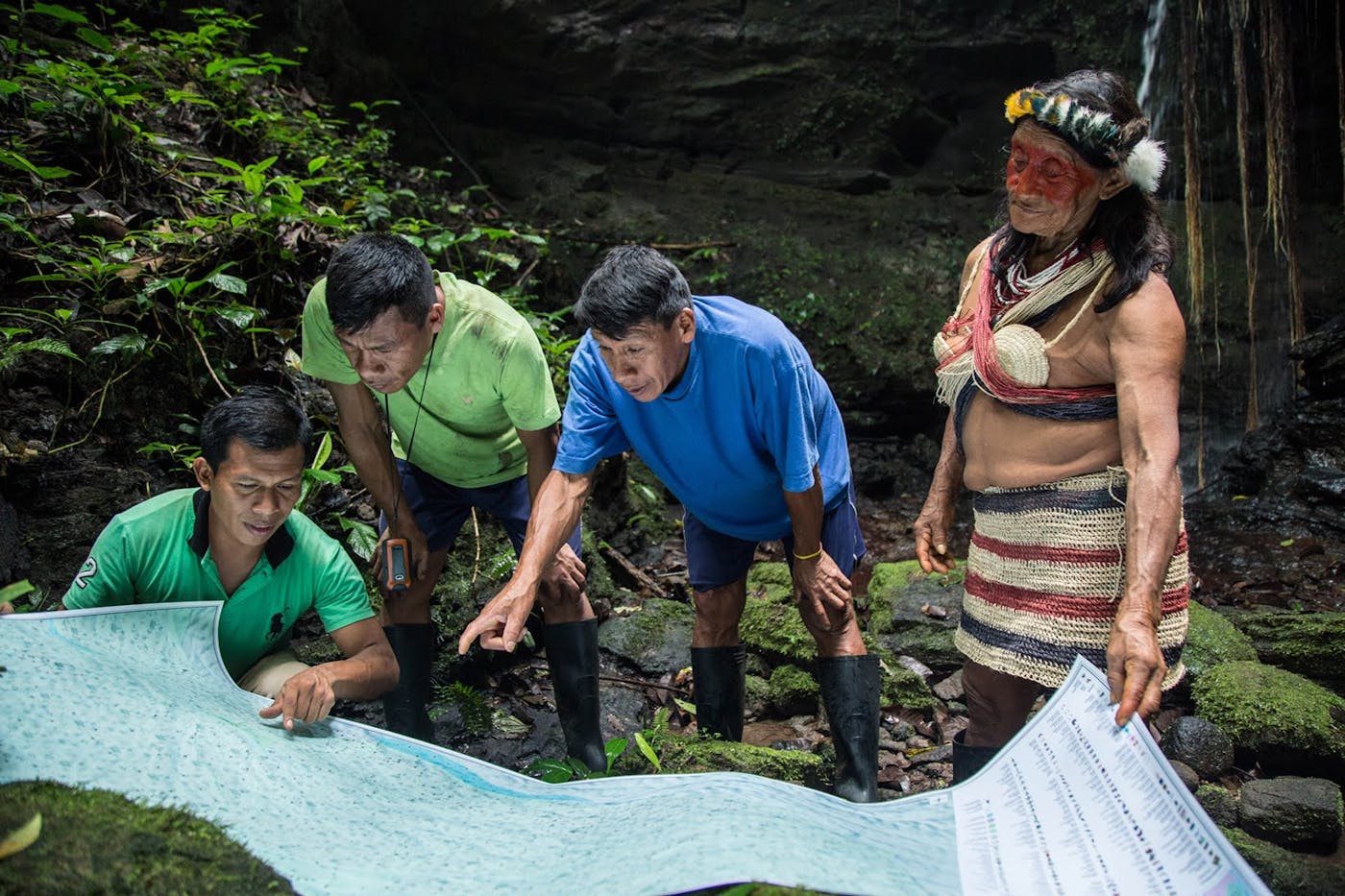
Indigenous lands of the Western Amazon have been invaded, degraded, polluted and pillaged for decades, with dramatic consequences for Indigenous health and livelihoods, biodiversity and the global climate. This project will support Indigenous-led mapping and real-time monitoring in the Upper Amazon.
Developed over the past decade in partnership with Indigenous tribes in the western Amazon, the group’s field-tested model enables Indigenous communities to detect, document, and deter logging, poaching, illegal mining, and contamination from extractive industries within their lands.
The group uses cutting-edge technologies that allows for offline, asynchronous data collection, as well as digital mapping and recording tools specifically tailored for Indigenous needs. Communities are supported and trained to govern their lands effectively.
Evidence gathered by Indigenous mapping and monitoring teams has proven critical to litigation, including the recent landmark case in which the Waorani people of Pastaza won a historic ruling in Ecuadorian court, protecting half a million acres of their territory in the Amazon rainforest from being earmarked for oil drilling.
Territorial maps that visually demonstrate both the importance of Indigenous territories and their ancestral ownership have aided several land titling claims. Through its effective storytelling platform, global support for this important work on indigenous land conservation has grown, with many tribal communities in other regions seeking to learn from the Waoroni example.
The territorial mapping and monitoring process brings together elders, women and youth to document their collective experience in rainforest territories, placing importance on the historical and cultural significance of the forest as well as documenting the daily use of forest resources.
This new model by and for Indigenous peoples, combines Indigenous-led methodology with the use of modern technologies. These include mobile mapping, satellite deforestation alerts, GPS, ARCGIS, aerial drones, motion sensor camera traps, photo and video cameras, customized geographic-information-system software, and other digital web tools.
At a time of evolving, often complex threats to Indigenous lands, the effort involved in community mapping and monitoring requires spending time in the forest to document threats, walking hunting trails and documenting wildlife and botanical life, visiting sacred waterfalls and the sites of historical battles.
These activities provide Indigenous communities with the opportunity to reflect collectively on the importance of their territories, to understand the nature of the threats facing them, and most importantly, strengthen their abilities to decide about the future of their homelands.